
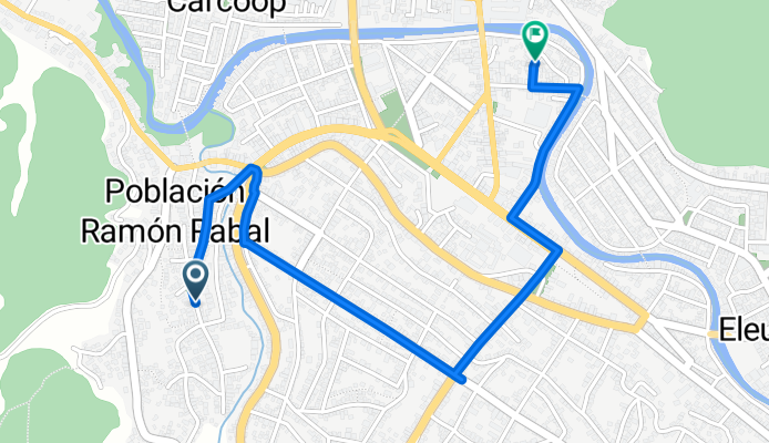
De Tucapel 340, Curanilahue a Janequeo 859, Curanilahue
A cycling route starting in Curanilahue, Región del Biobío, Chile.
Overview
About this route
- 7 min
- Duration
- 2.2 km
- Distance
- 55 m
- Ascent
- 55 m
- Descent
- 18 km/h
- Avg. speed
- ---
- Avg. speed
Route quality
Waytypes & surfaces along the route
Waytypes
Road
1.1 km
(48 %)
Quiet road
0.9 km
(38 %)
Surfaces
Paved
0.7 km
(30 %)
Paved (undefined)
0.6 km
(29 %)
Concrete
0 km
(1 %)
Undefined
1.5 km
(70 %)
Continue with Bikemap
Use, edit, or download this cycling route
You would like to ride De Tucapel 340, Curanilahue a Janequeo 859, Curanilahue or customize it for your own trip? Here is what you can do with this Bikemap route:
Free features
- Save this route as favorite or in collections
- Copy & plan your own version of this route
- Sync your route with Garmin or Wahoo
Premium features
Free trial for 3 days, or one-time payment. More about Bikemap Premium.
- Navigate this route on iOS & Android
- Export a GPX / KML file of this route
- Create your custom printout (try it for free)
- Download this route for offline navigation
Discover more Premium features.
Get Bikemap PremiumFrom our community
Other popular routes starting in Curanilahue
 Ruta villa alegre los ñancos
- Distance
- 48.4 km
- Ascent
- 671 m
- Descent
- 675 m
- Location
- Curanilahue, Región del Biobío, Chile
 Paseo rápido en Los Álamos
- Distance
- 17 km
- Ascent
- 376 m
- Descent
- 378 m
- Location
- Curanilahue, Región del Biobío, Chile
 Ruta desde Cruce Calle Caupolicán (Curanilahue) - Mundo Nuevo - Cruce O-940 (Los Cruceros), Curanilahue
- Distance
- 12.5 km
- Ascent
- 156 m
- Descent
- 228 m
- Location
- Curanilahue, Región del Biobío, Chile
 Ruta herrera vateas
- Distance
- 6.9 km
- Ascent
- 119 m
- Descent
- 152 m
- Location
- Curanilahue, Región del Biobío, Chile
 De Tucapel 340, Curanilahue a Janequeo 859, Curanilahue
- Distance
- 2.2 km
- Ascent
- 55 m
- Descent
- 55 m
- Location
- Curanilahue, Región del Biobío, Chile
 Ruta relajada en cañete
- Distance
- 20.5 km
- Ascent
- 0 m
- Descent
- 0 m
- Location
- Curanilahue, Región del Biobío, Chile
 Colico Sur, Curanilahue a El frutillar, Curanilahue
- Distance
- 4.2 km
- Ascent
- 157 m
- Descent
- 158 m
- Location
- Curanilahue, Región del Biobío, Chile
 El frutillar, Curanilahue a Los copihues, Curanilahue
- Distance
- 8 km
- Ascent
- 196 m
- Descent
- 189 m
- Location
- Curanilahue, Región del Biobío, Chile
Open it in the app