

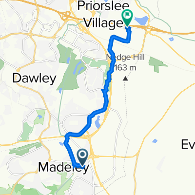
LEJOG / JOGLE Telford avoiding dangerous A442
A cycling route starting in Madeley, England, United Kingdom.
Overview
About this route
Telford A442 Please avoid after LEJOG fatality in 2010.
In the summer 2010 there was a fatality when a cyclist participating in a LEJOG sponsored ride was hit by a car whilst travelling on the A442 dual carriageway around Telford. The dual carriageway can be avoided by following the route of what was the A442 of 40 yrs ago. No local cyclists would entertain the prospect of cycling on A442 dual carriageway, it’s cyclist that don’t know any different who need to be informed of the dangers.
Thanks to Geoff Shinner, Sustrans Liaison Ranger at Telford & Wrekin for getting in touch with the alternative route & instructions
- -:--
- Duration
- 14.8 km
- Distance
- 137 m
- Ascent
- 169 m
- Descent
- ---
- Avg. speed
- ---
- Max. altitude

Route quality
Waytypes & surfaces along the route
Waytypes
Road
4.9 km
(33 %)
Quiet road
3.7 km
(25 %)
Surfaces
Paved
3.3 km
(22 %)
Asphalt
3.3 km
(22 %)
Undefined
11.5 km
(78 %)
Continue with Bikemap
Use, edit, or download this cycling route
You would like to ride LEJOG / JOGLE Telford avoiding dangerous A442 or customize it for your own trip? Here is what you can do with this Bikemap route:
Free features
- Save this route as favorite or in collections
- Copy & plan your own version of this route
- Sync your route with Garmin or Wahoo
Premium features
Free trial for 3 days, or one-time payment. More about Bikemap Premium.
- Navigate this route on iOS & Android
- Export a GPX / KML file of this route
- Create your custom printout (try it for free)
- Download this route for offline navigation
Discover more Premium features.
Get Bikemap PremiumFrom our community
Other popular routes starting in Madeley
 f. LEJOG Day 6
- Distance
- 76.7 km
- Ascent
- 244 m
- Descent
- 263 m
- Location
- Madeley, England, United Kingdom
 20 Queens Ct, Telford do Stafford Park Seven, Stafford Park, Telford
- Distance
- 7.2 km
- Ascent
- 74 m
- Descent
- 39 m
- Location
- Madeley, England, United Kingdom
 Bridgwood 14 to Stafford Park 5 5
- Distance
- 4.3 km
- Ascent
- 38 m
- Descent
- 30 m
- Location
- Madeley, England, United Kingdom
 Mercian Way
- Distance
- 3.3 km
- Ascent
- 39 m
- Descent
- 35 m
- Location
- Madeley, England, United Kingdom
 NCN 45around Coalport
- Distance
- 24.3 km
- Ascent
- 247 m
- Descent
- 245 m
- Location
- Madeley, England, United Kingdom
 LEJOG / JOGLE Telford avoiding dangerous A442
- Distance
- 14.8 km
- Ascent
- 137 m
- Descent
- 169 m
- Location
- Madeley, England, United Kingdom
 day 5 105 miles
- Distance
- 169.5 km
- Ascent
- 486 m
- Descent
- 504 m
- Location
- Madeley, England, United Kingdom
 Bridgwood 14 to Thetford Chase 131
- Distance
- 3.6 km
- Ascent
- 59 m
- Descent
- 19 m
- Location
- Madeley, England, United Kingdom
Open it in the app