

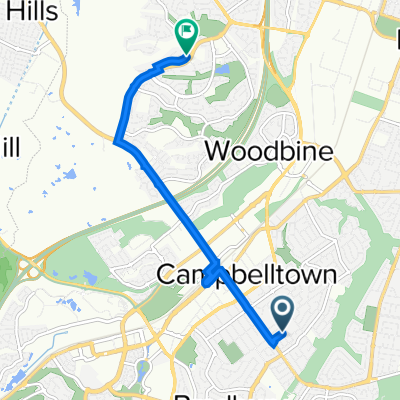
Camden bypass via menangle via burragorang rd.
A cycling route starting in Campbelltown, New South Wales, Australia.
Overview
About this route
0
Great ride with some challenging climbs on burragorang road. Shoulder on road most of the way but a bit rough out the back of Menangle.
- -:--
- Duration
- 56.2 km
- Distance
- 454 m
- Ascent
- 454 m
- Descent
- ---
- Avg. speed
- ---
- Max. altitude
mrchucky
created this 15 years ago
Route quality
Waytypes & surfaces along the route
Waytypes
Road
8.4 km
15 %
Cycleway
4.5 km
8 %
Surfaces
Paved
53.4 km
(95 %)
Paved (undefined)
41.6 km
74 %
Asphalt
11.8 km
21 %
Undefined
2.8 km
5 %
Continue with Bikemap
Use, edit, or download this cycling route
You would like to ride Camden bypass via menangle via burragorang rd. or customize it for your own trip? Here is what you can do with this Bikemap route:
Free features
- Save this route as favorite or in collections
- Copy & plan your own version of this route
- Sync your route with Garmin or Wahoo
Premium features
Free trial for 3 days, or one-time payment. More about Bikemap Premium.
- Navigate this route on iOS & Android
- Export a GPX / KML file of this route
- Create your custom printout (try it for free)
- Download this route for offline navigation
Discover more Premium features.
Get Bikemap PremiumFrom our community
Other popular routes starting in Campbelltown
- 51–61 Deans Road, Airds to 1–19 Feathertop Avenue, Minto0
- 8.3 km
- 50 m
- 90 m
- Campbelltown, New South Wales, Australia
- Deans Road, Airds to 29 Feathertop Avenue, Minto0
- 7.4 km
- 0 m
- 30 m
- Campbelltown, New South Wales, Australia
- 12 Bilgola St, Campbelltown to 15 Minchinbury Tce, Eschol Park2
- 6.6 km
- 55 m
- 75 m
- Campbelltown, New South Wales, Australia


Open it in the app