
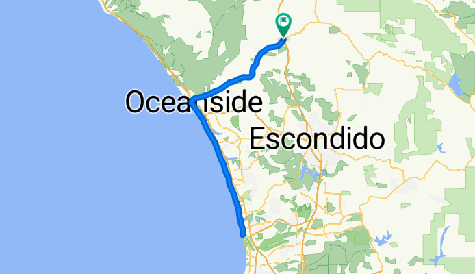
North County 75
A cycling route starting in Bonsall, California, United States.
Overview
About this route
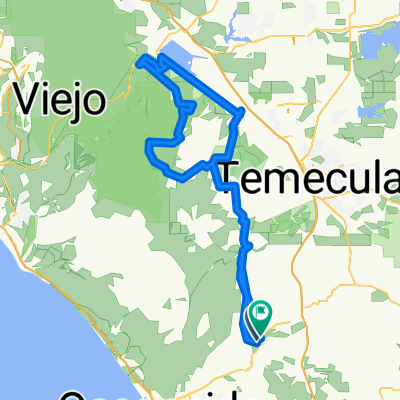
76 to Oceanside, PCH to Torrey Pines
- -:--
- Duration
- 121.5 km
- Distance
- 363 m
- Ascent
- 363 m
- Descent
- ---
- Avg. speed
- ---
- Max. altitude

Continue with Bikemap
Use, edit, or download this cycling route
You would like to ride North County 75 or customize it for your own trip? Here is what you can do with this Bikemap route:
Free features
- Save this route as favorite or in collections
- Copy & plan your own version of this route
- Split it into stages to create a multi-day tour
- Sync your route with Garmin or Wahoo
Premium features
Free trial for 3 days, or one-time payment. More about Bikemap Premium.
- Navigate this route on iOS & Android
- Export a GPX / KML file of this route
- Create your custom printout (try it for free)
- Download this route for offline navigation
Discover more Premium features.
Get Bikemap PremiumFrom our community
Other popular routes starting in Bonsall
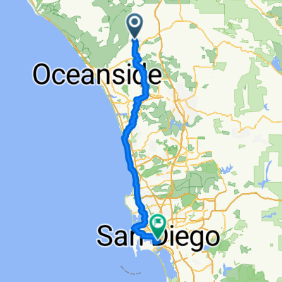 Bonsall - San Diego
- Distance
- 100.4 km
- Ascent
- 1,230 m
- Descent
- 1,345 m
- Location
- Bonsall, California, United States
 Lilacasdgasdfgh
- Distance
- 60.8 km
- Ascent
- 761 m
- Descent
- 760 m
- Location
- Bonsall, California, United States
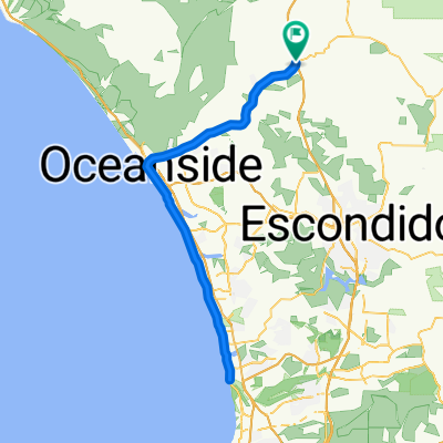
 5030 Tyler St, Oceanside to 284 S Harbor Dr, Oceanside
- Distance
- 13.1 km
- Ascent
- 26 m
- Descent
- 55 m
- Location
- Bonsall, California, United States
 North County 75
- Distance
- 121.5 km
- Ascent
- 363 m
- Descent
- 363 m
- Location
- Bonsall, California, United States
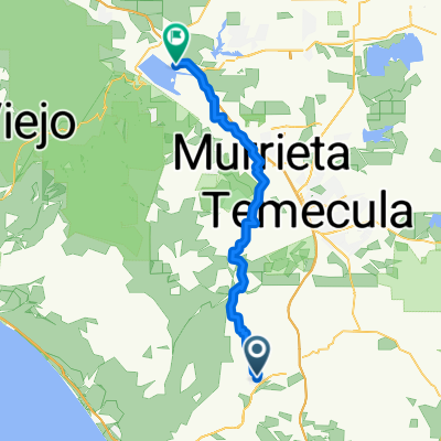 4284 Fallsbrae Rd, Fallbrook to 121 S Main St, Lake Elsinore
- Distance
- 59.8 km
- Ascent
- 780 m
- Descent
- 500 m
- Location
- Bonsall, California, United States
 PalaMesaLoop
- Distance
- 72.9 km
- Ascent
- 1,139 m
- Descent
- 1,140 m
- Location
- Bonsall, California, United States
 Wilderness Trail
- Distance
- 139.2 km
- Ascent
- 1,755 m
- Descent
- 1,772 m
- Location
- Bonsall, California, United States
 4495 Sleeping Indian Rd, Fallbrook to 460 Taylor Dr, Oceanside
- Distance
- 16.6 km
- Ascent
- 255 m
- Descent
- 349 m
- Location
- Bonsall, California, United States
Open it in the app