

DOLCE - BW - 60KM
A cycling route starting in Hoeilaart, Flemish Region, Belgium.
Overview
About this route
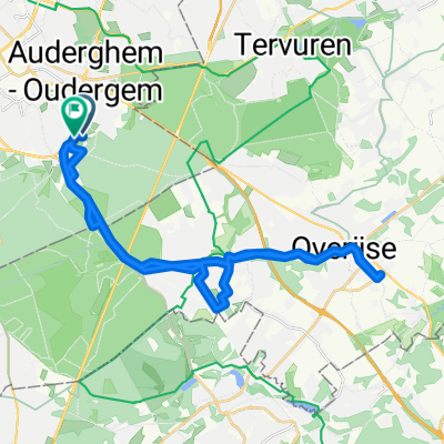
Dedicated to dedicated two-wheel athletes, this 58 km route from Dolce by Wyndham La Hulpe Brussels will let you discover part of the two Brabants. From Hoeilaart to Grez-Doiceau, this road course with a total climb of 612 m will let you explore the region and some remarkable places such as Hoeilaart Castle, the Notre-Dame church in Bossut at Grez-Doiceau, the church of Dion Valmont, Kasteel Merode, and the splendid Lake Genval.
- 4 h 14 min
- Duration
- 58.3 km
- Distance
- 639 m
- Ascent
- 637 m
- Descent
- 13.8 km/h
- Avg. speed
- ---
- Max. altitude
Route quality
Waytypes & surfaces along the route
Waytypes
Quiet road
22.1 km
(38 %)
Road
14.6 km
(25 %)
Surfaces
Paved
29.1 km
(50 %)
Unpaved
4.1 km
(7 %)
Asphalt
20.4 km
(35 %)
Concrete
7.6 km
(13 %)
Continue with Bikemap
Use, edit, or download this cycling route
You would like to ride DOLCE - BW - 60KM or customize it for your own trip? Here is what you can do with this Bikemap route:
Free features
- Save this route as favorite or in collections
- Copy & plan your own version of this route
- Sync your route with Garmin or Wahoo
Premium features
Free trial for 3 days, or one-time payment. More about Bikemap Premium.
- Navigate this route on iOS & Android
- Export a GPX / KML file of this route
- Create your custom printout (try it for free)
- Download this route for offline navigation
Discover more Premium features.
Get Bikemap PremiumFrom our community
Other popular routes starting in Hoeilaart
 Hoeilaart-StGenRode H/T 29
- Distance
- 29.2 km
- Ascent
- 233 m
- Descent
- 232 m
- Location
- Hoeilaart, Flemish Region, Belgium
 Picnic No Mud 38 S
- Distance
- 37.5 km
- Ascent
- 291 m
- Descent
- 289 m
- Location
- Hoeilaart, Flemish Region, Belgium
 Zavelpad 27
- Distance
- 26.1 km
- Ascent
- 207 m
- Descent
- 206 m
- Location
- Hoeilaart, Flemish Region, Belgium
 Zoniënwoud - H
- Distance
- 54.5 km
- Ascent
- 290 m
- Descent
- 301 m
- Location
- Hoeilaart, Flemish Region, Belgium
 Nero-Route
- Distance
- 27.2 km
- Ascent
- 230 m
- Descent
- 227 m
- Location
- Hoeilaart, Flemish Region, Belgium
 Sunset Race Rebels - 40k - G3 - 18 sept 2025
- Distance
- 30 km
- Ascent
- 275 m
- Descent
- 272 m
- Location
- Hoeilaart, Flemish Region, Belgium
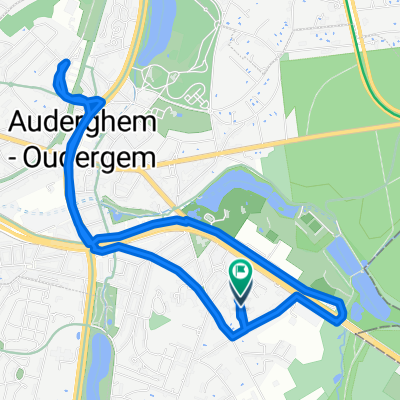 Rue Georges Huygens, Auderghem à Rue Georges Huygens, Auderghem
- Distance
- 6.2 km
- Ascent
- 91 m
- Descent
- 91 m
- Location
- Hoeilaart, Flemish Region, Belgium
 Hoeilaart-StGenRode H/T 22
- Distance
- 21.6 km
- Ascent
- 148 m
- Descent
- 146 m
- Location
- Hoeilaart, Flemish Region, Belgium
Open it in the app