

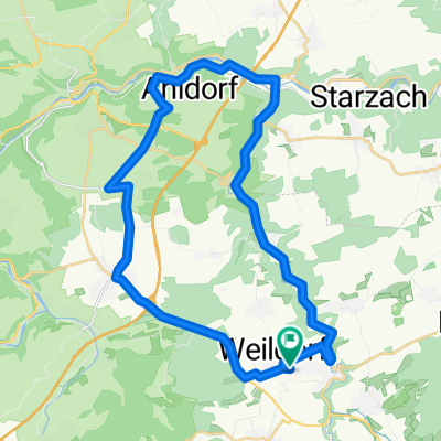
Haigerloch - Horb - Sulz - Haigerloch
A cycling route starting in Haigerloch, Baden-Wurttemberg, Germany.
Overview
About this route
Eating up kilometers after the break
Average just under 25
- -:--
- Duration
- 59.5 km
- Distance
- 401 m
- Ascent
- 401 m
- Descent
- ---
- Avg. speed
- ---
- Max. altitude
Continue with Bikemap
Use, edit, or download this cycling route
You would like to ride Haigerloch - Horb - Sulz - Haigerloch or customize it for your own trip? Here is what you can do with this Bikemap route:
Free features
- Save this route as favorite or in collections
- Copy & plan your own version of this route
- Sync your route with Garmin or Wahoo
Premium features
Free trial for 3 days, or one-time payment. More about Bikemap Premium.
- Navigate this route on iOS & Android
- Export a GPX / KML file of this route
- Create your custom printout (try it for free)
- Download this route for offline navigation
Discover more Premium features.
Get Bikemap PremiumFrom our community
Other popular routes starting in Haigerloch
 Kleine Abendrunde Haigerloch
- Distance
- 25.2 km
- Ascent
- 214 m
- Descent
- 226 m
- Location
- Haigerloch, Baden-Wurttemberg, Germany
 Noch ne FeierabendRunde bei Haigerloch
- Distance
- 32.7 km
- Ascent
- 469 m
- Descent
- 471 m
- Location
- Haigerloch, Baden-Wurttemberg, Germany
 Erlaheim1
- Distance
- 20.1 km
- Ascent
- 157 m
- Descent
- 157 m
- Location
- Haigerloch, Baden-Wurttemberg, Germany
 Trillfingen - Bodelshausen - Trillfingen
- Distance
- 38.3 km
- Ascent
- 504 m
- Descent
- 579 m
- Location
- Haigerloch, Baden-Wurttemberg, Germany
 An Eyach und Neckar - Kilometer spulen
- Distance
- 84.3 km
- Ascent
- 574 m
- Descent
- 575 m
- Location
- Haigerloch, Baden-Wurttemberg, Germany
 Haigerloch - Horb - Sulz - Haigerloch
- Distance
- 59.5 km
- Ascent
- 401 m
- Descent
- 401 m
- Location
- Haigerloch, Baden-Wurttemberg, Germany
 Owingen - Zimmern udB
- Distance
- 19.3 km
- Ascent
- 327 m
- Descent
- 225 m
- Location
- Haigerloch, Baden-Wurttemberg, Germany
 Haigerloch - Eyach - Unterjesingen
- Distance
- 34.5 km
- Ascent
- 203 m
- Descent
- 288 m
- Location
- Haigerloch, Baden-Wurttemberg, Germany
Open it in the app