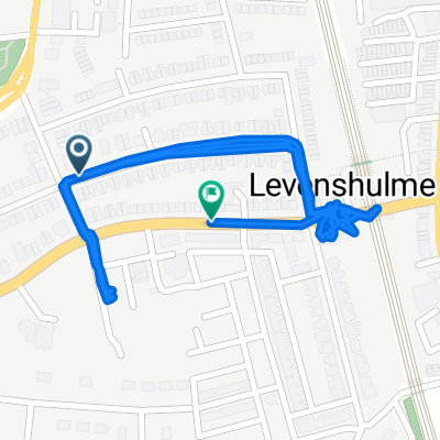
Chesterfield Cycle Route
A cycling route starting in Burnage, England, United Kingdom.
Overview
About this route
- -:--
- Duration
- 2.6 km
- Distance
- 24 m
- Ascent
- 0 m
- Descent
- ---
- Avg. speed
- ---
- Max. altitude
Route quality
Waytypes & surfaces along the route
Waytypes
Quiet road
2.4 km
(93 %)
Pedestrian area
0.2 km
(7 %)
Undefined
-0 km
(<1 %)
Surfaces
Paved
0.2 km
(9 %)
Asphalt
0.2 km
(9 %)
Undefined
2.4 km
(91 %)
Route highlights
Points of interest along the route
Point of interest after 1.3 km
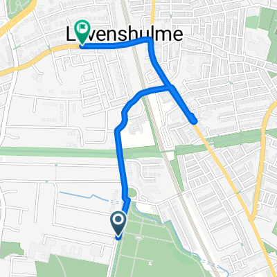
Chatsworth Road to Oakfield Avenue https://chesterfieldcycleroute.commonplace.is/proposals/section-1-chatsworth-road-to-oakfield-avenue
Continue with Bikemap
Use, edit, or download this cycling route
You would like to ride Chesterfield Cycle Route or customize it for your own trip? Here is what you can do with this Bikemap route:
Free features
- Save this route as favorite or in collections
- Copy & plan your own version of this route
- Sync your route with Garmin or Wahoo
Premium features
Free trial for 3 days, or one-time payment. More about Bikemap Premium.
- Navigate this route on iOS & Android
- Export a GPX / KML file of this route
- Create your custom printout (try it for free)
- Download this route for offline navigation
Discover more Premium features.
Get Bikemap PremiumFrom our community
Other popular routes starting in Burnage
- Beech Range to Barlow Road/Broom Lane
- Distance
- 2.2 km
- Ascent
- 3 m
- Descent
- 0 m
- Location
- Burnage, England, United Kingdom
- 281 Slade Lane, Manchester to 166 Longford Road West, Stockport
- Distance
- 2.2 km
- Ascent
- 25 m
- Descent
- 6 m
- Location
- Burnage, England, United Kingdom
- Fallowfield Loop, Ashton Canal, City Centre, Wilmslow Road
- Distance
- 20.9 km
- Ascent
- 344 m
- Descent
- 345 m
- Location
- Burnage, England, United Kingdom
- Levenshulme - Marple - New Mills - Disley - Levenshulme
- Distance
- 36.4 km
- Ascent
- 242 m
- Descent
- 239 m
- Location
- Burnage, England, United Kingdom
- Reddish Vale, Brinnington/Portwood, Stockport Road
- Distance
- 12.4 km
- Ascent
- 93 m
- Descent
- 90 m
- Location
- Burnage, England, United Kingdom
- Levenshulme to New Mills
- Distance
- 17.8 km
- Ascent
- 213 m
- Descent
- 119 m
- Location
- Burnage, England, United Kingdom
- To Reddish
- Distance
- 17.9 km
- Ascent
- 110 m
- Descent
- 113 m
- Location
- Burnage, England, United Kingdom
- Chesterfield Cycle Route
- Distance
- 2.6 km
- Ascent
- 24 m
- Descent
- 0 m
- Location
- Burnage, England, United Kingdom
Open it in the app