

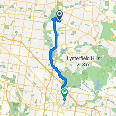
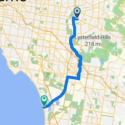
Wantirna - Cockatoo Loop via Mt Dandenong
A cycling route starting in Wantirna, Victoria, Australia.
Overview
About this route
Cool Mountain Roads, Fern Gullys, awsome descents with views opening up on occasion
Start early to avoid the traffic
We drove from various locations and met in Wantirna as the start point.
Good Bakery at Emerald for Coffee and pastry stop.
Option to Skip Selby and Belgrave: turn right onto Grantulla Road after Menzies Creek.
- -:--
- Duration
- 83.5 km
- Distance
- 1,170 m
- Ascent
- 1,170 m
- Descent
- ---
- Avg. speed
- ---
- Max. altitude

Route quality
Waytypes & surfaces along the route
Waytypes
Cycleway
10 km
(12 %)
Quiet road
8.4 km
(10 %)
Surfaces
Paved
66.8 km
(80 %)
Unpaved
0.8 km
(1 %)
Asphalt
62.6 km
(75 %)
Paved (undefined)
2.5 km
(3 %)
Continue with Bikemap
Use, edit, or download this cycling route
You would like to ride Wantirna - Cockatoo Loop via Mt Dandenong or customize it for your own trip? Here is what you can do with this Bikemap route:
Free features
- Save this route as favorite or in collections
- Copy & plan your own version of this route
- Split it into stages to create a multi-day tour
- Sync your route with Garmin or Wahoo
Premium features
Free trial for 3 days, or one-time payment. More about Bikemap Premium.
- Navigate this route on iOS & Android
- Export a GPX / KML file of this route
- Create your custom printout (try it for free)
- Download this route for offline navigation
Discover more Premium features.
Get Bikemap PremiumFrom our community
Other popular routes starting in Wantirna
 51 Milpera Crescent, Wantirna to 51 Milpera Crescent, Wantirna
- Distance
- 13.2 km
- Ascent
- 94 m
- Descent
- 93 m
- Location
- Wantirna, Victoria, Australia
 Vermont Sth to Docklands
- Distance
- 82.5 km
- Ascent
- 295 m
- Descent
- 294 m
- Location
- Wantirna, Victoria, Australia
 The Basin Loop
- Distance
- 26.2 km
- Ascent
- 169 m
- Descent
- 166 m
- Location
- Wantirna, Victoria, Australia
 14-12-11 Vermont-Boronia Loop
- Distance
- 24.6 km
- Ascent
- 128 m
- Descent
- 128 m
- Location
- Wantirna, Victoria, Australia
 Saturday trip
- Distance
- 19.7 km
- Ascent
- 0 m
- Descent
- 12 m
- Location
- Wantirna, Victoria, Australia
 Morack Road 190, Vermont South to Morack Road 190, Vermont South
- Distance
- 49.2 km
- Ascent
- 550 m
- Descent
- 542 m
- Location
- Wantirna, Victoria, Australia
 From Wantirna to Dandenong
- Distance
- 20.6 km
- Ascent
- 65 m
- Descent
- 141 m
- Location
- Wantirna, Victoria, Australia
 From Wantirna to Carrum
- Distance
- 36.6 km
- Ascent
- 68 m
- Descent
- 170 m
- Location
- Wantirna, Victoria, Australia
Open it in the app