
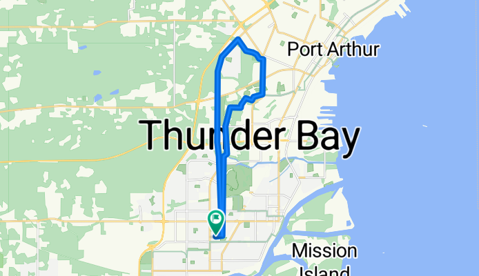
Golf Links Loop
A cycling route starting in Thunder Bay, Ontario, Canada.
Overview
About this route
- -:--
- Duration
- 16.2 km
- Distance
- 49 m
- Ascent
- 49 m
- Descent
- ---
- Avg. speed
- ---
- Max. altitude

Route quality
Waytypes & surfaces along the route
Waytypes
Path
14.9 km
(92 %)
Access road
0.6 km
(4 %)
Quiet road
0.6 km
(4 %)
Surfaces
Paved
16.2 km
(100 %)
Paved (undefined)
13.6 km
(84 %)
Asphalt
2.6 km
(16 %)
Continue with Bikemap
Use, edit, or download this cycling route
You would like to ride Golf Links Loop or customize it for your own trip? Here is what you can do with this Bikemap route:
Free features
- Save this route as favorite or in collections
- Copy & plan your own version of this route
- Sync your route with Garmin or Wahoo
Premium features
Free trial for 3 days, or one-time payment. More about Bikemap Premium.
- Navigate this route on iOS & Android
- Export a GPX / KML file of this route
- Create your custom printout (try it for free)
- Download this route for offline navigation
Discover more Premium features.
Get Bikemap PremiumFrom our community
Other popular routes starting in Thunder Bay
 Gillies-Nolalu 110km
- Distance
- 108.3 km
- Ascent
- 579 m
- Descent
- 578 m
- Location
- Thunder Bay, Ontario, Canada
 Sandy beach
- Distance
- 35.7 km
- Ascent
- 66 m
- Descent
- 107 m
- Location
- Thunder Bay, Ontario, Canada
 2016 - Canada - Jour 39
- Distance
- 140.8 km
- Ascent
- 455 m
- Descent
- 388 m
- Location
- Thunder Bay, Ontario, Canada
 1250 Golf Links Rd, Thunder Bay to 1250 Golf Links Rd, Thunder Bay
- Distance
- 8.7 km
- Ascent
- 87 m
- Descent
- 90 m
- Location
- Thunder Bay, Ontario, Canada
 72km: poline- mining-maki-miller-morrow john
- Distance
- 72.4 km
- Ascent
- 202 m
- Descent
- 201 m
- Location
- Thunder Bay, Ontario, Canada
 Jim house
- Distance
- 16.3 km
- Ascent
- 72 m
- Descent
- 41 m
- Location
- Thunder Bay, Ontario, Canada
 FIRST RIDE- Kakkabekka Falls
- Distance
- 29 km
- Ascent
- 223 m
- Descent
- 168 m
- Location
- Thunder Bay, Ontario, Canada
 Chapples+River
- Distance
- 9.7 km
- Ascent
- 12 m
- Descent
- 14 m
- Location
- Thunder Bay, Ontario, Canada
Open it in the app