

Bretenière-Esbarres-Echigey-Breteniere
A cycling route starting in Ouges, Bourgogne-Franche-Comté, France.
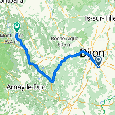
Overview
About this route
- 2 h 53 min
- Duration
- 49.9 km
- Distance
- 53 m
- Ascent
- 49 m
- Descent
- 17.3 km/h
- Avg. speed
- ---
- Max. altitude
Route quality
Waytypes & surfaces along the route
Waytypes
Road
22.9 km
(46 %)
Quiet road
12 km
(24 %)
Surfaces
Paved
13 km
(26 %)
Unpaved
1.5 km
(3 %)
Asphalt
12.5 km
(25 %)
Unpaved (undefined)
1 km
(2 %)
Continue with Bikemap
Use, edit, or download this cycling route
You would like to ride Bretenière-Esbarres-Echigey-Breteniere or customize it for your own trip? Here is what you can do with this Bikemap route:
Free features
- Save this route as favorite or in collections
- Copy & plan your own version of this route
- Sync your route with Garmin or Wahoo
Premium features
Free trial for 3 days, or one-time payment. More about Bikemap Premium.
- Navigate this route on iOS & Android
- Export a GPX / KML file of this route
- Create your custom printout (try it for free)
- Download this route for offline navigation
Discover more Premium features.
Get Bikemap PremiumFrom our community
Other popular routes starting in Ouges
 Recovered Route
- Distance
- 0.8 km
- Ascent
- 0 m
- Descent
- 0 m
- Location
- Ouges, Bourgogne-Franche-Comté, France
 Ouges - Semur-en-Auxois
- Distance
- 93.8 km
- Ascent
- 439 m
- Descent
- 316 m
- Location
- Ouges, Bourgogne-Franche-Comté, France
 Bretenière-Esbarres-Echigey-Breteniere
- Distance
- 49.9 km
- Ascent
- 53 m
- Descent
- 49 m
- Location
- Ouges, Bourgogne-Franche-Comté, France
 Tour de France 2010 | 6. Etap # Dijon - Macon (132 km)
- Distance
- 131.8 km
- Ascent
- 263 m
- Descent
- 310 m
- Location
- Ouges, Bourgogne-Franche-Comté, France
 de Bretenière aux vignes
- Distance
- 31.2 km
- Ascent
- 140 m
- Descent
- 122 m
- Location
- Ouges, Bourgogne-Franche-Comté, France
 Route stable en Ouges
- Distance
- 22 km
- Ascent
- 32 m
- Descent
- 32 m
- Location
- Ouges, Bourgogne-Franche-Comté, France
 De 19bis Rue Guynemer, Ouges à Chemin de Contre-Halage du Canal, Dijon
- Distance
- 12.6 km
- Ascent
- 99 m
- Descent
- 51 m
- Location
- Ouges, Bourgogne-Franche-Comté, France
 De 19 Rue des Bateliers, Bretenière à 15 Rue des Bateliers, Bretenière
- Distance
- 35.1 km
- Ascent
- 128 m
- Descent
- 127 m
- Location
- Ouges, Bourgogne-Franche-Comté, France
Open it in the app