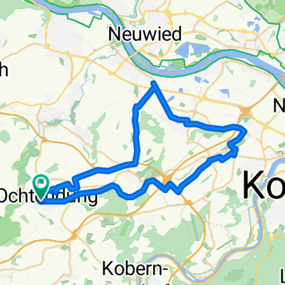
Radmarathon Ochtendung 218 km
- 211.7 km
- 1,723 m
- 1,723 m
- Ochtendung, Rhineland-Palatinate, Germany
Fünf-Täler-RTF - 77 km
RTF des DJK Ochtendung 1920 e.V.
Alle weiteren Hinweise zu dieser Strecke -> hier anklicken
Quiet road
10.7 km14 %Track
9.9 km13 %Paved
54.9 km(72 %)Unpaved
1.5 km(2 %)Asphalt
54.9 km72 %Ground
1.5 km2 %Undefined
19.8 km26 %Kontrolle 1 <b>Binnigen</b>
Kontrolle 4 <b>Münstermaifeld</b>
Free trial for 3 days, or one-time payment. More about Bikemap Premium.
Discover more Premium features.
Get Bikemap PremiumOpen it in the app