

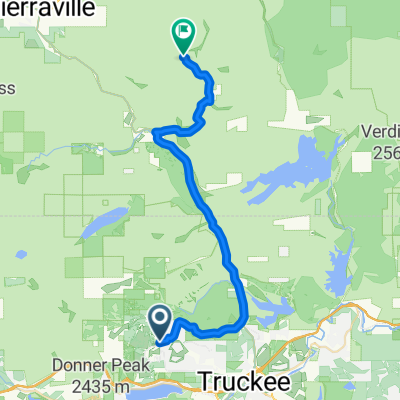
r218 ROAM
A cycling route starting in Truckee, California, United States.
Overview
About this route
<span style="font-family: Arial, Helvetica, sans-serif; font-size: 11px;">prosser creek reservoir campground-sierraville-haskell creek homesites-north yuba river-lower sardine laker-gold lake-lily lake-gray eagle creek-middle fork-greaegle-cromberg-spring garden-fast quincy-radio hill(boulder camp)</span>
- -:--
- Duration
- 131 km
- Distance
- 1,421 m
- Ascent
- 1,977 m
- Descent
- ---
- Avg. speed
- ---
- Max. altitude
Route quality
Waytypes & surfaces along the route
Waytypes
Quiet road
10.5 km
(8 %)
Access road
1.3 km
(1 %)
Surfaces
Paved
24.9 km
(19 %)
Unpaved
5.2 km
(4 %)
Asphalt
24.9 km
(19 %)
Unpaved (undefined)
5.2 km
(4 %)
Undefined
100.8 km
(77 %)
Continue with Bikemap
Use, edit, or download this cycling route
You would like to ride r218 ROAM or customize it for your own trip? Here is what you can do with this Bikemap route:
Free features
- Save this route as favorite or in collections
- Copy & plan your own version of this route
- Split it into stages to create a multi-day tour
- Sync your route with Garmin or Wahoo
Premium features
Free trial for 3 days, or one-time payment. More about Bikemap Premium.
- Navigate this route on iOS & Android
- Export a GPX / KML file of this route
- Create your custom printout (try it for free)
- Download this route for offline navigation
Discover more Premium features.
Get Bikemap PremiumFrom our community
Other popular routes starting in Truckee
 Gold Bend, Truckee to Gold Bend, Truckee
- Distance
- 18.7 km
- Ascent
- 397 m
- Descent
- 398 m
- Location
- Truckee, California, United States
 Route to 11769 Tundra Drive, Truckee, CA 96161
- Distance
- 25.3 km
- Ascent
- 640 m
- Descent
- 642 m
- Location
- Truckee, California, United States
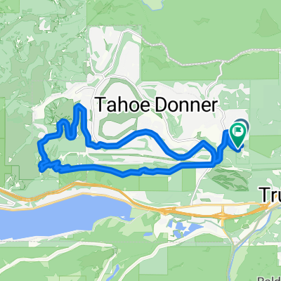
 Mountain Bike Loop Truckee
- Distance
- 23.5 km
- Ascent
- 670 m
- Descent
- 669 m
- Location
- Truckee, California, United States
 r218 ROAM
- Distance
- 131 km
- Ascent
- 1,421 m
- Descent
- 1,977 m
- Location
- Truckee, California, United States
 Easy Trail
- Distance
- 9.7 km
- Ascent
- 190 m
- Descent
- 192 m
- Location
- Truckee, California, United States
 Gold Bend, Truckee to Gold Bend, Truckee
- Distance
- 18.6 km
- Ascent
- 397 m
- Descent
- 398 m
- Location
- Truckee, California, United States
 Skislope to Rim Trail
- Distance
- 20.3 km
- Ascent
- 547 m
- Descent
- 549 m
- Location
- Truckee, California, United States
 Truckee - Verdi
- Distance
- 37 km
- Ascent
- 657 m
- Descent
- 721 m
- Location
- Truckee, California, United States
Open it in the app