

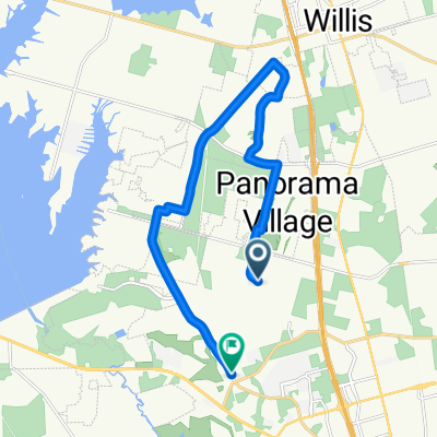
Ridgelakes 20.3 km (12.6mile) route
A cycling route starting in Panorama Village, Texas, United States.
Overview
About this route
Route through Ridgelakes Shores and Woodforest neighborhoods.
- -:--
- Duration
- 20.3 km
- Distance
- 77 m
- Ascent
- 77 m
- Descent
- ---
- Avg. speed
- ---
- Max. altitude
Route quality
Waytypes & surfaces along the route
Waytypes
Road
8.3 km
(41 %)
Quiet road
7.9 km
(39 %)
Undefined
4.1 km
(20 %)
Surfaces
Paved
20.3 km
(100 %)
Paved (undefined)
19.5 km
(96 %)
Asphalt
0.8 km
(4 %)
Continue with Bikemap
Use, edit, or download this cycling route
You would like to ride Ridgelakes 20.3 km (12.6mile) route or customize it for your own trip? Here is what you can do with this Bikemap route:
Free features
- Save this route as favorite or in collections
- Copy & plan your own version of this route
- Sync your route with Garmin or Wahoo
Premium features
Free trial for 3 days, or one-time payment. More about Bikemap Premium.
- Navigate this route on iOS & Android
- Export a GPX / KML file of this route
- Create your custom printout (try it for free)
- Download this route for offline navigation
Discover more Premium features.
Get Bikemap PremiumFrom our community
Other popular routes starting in Panorama Village
 Boucle Montgomery Park
- Distance
- 35.2 km
- Ascent
- 236 m
- Descent
- 237 m
- Location
- Panorama Village, Texas, United States
 830/Seven coves tip to tip
- Distance
- 33 km
- Ascent
- 245 m
- Descent
- 245 m
- Location
- Panorama Village, Texas, United States
 Restful route in Montgomery
- Distance
- 3.1 km
- Ascent
- 30 m
- Descent
- 29 m
- Location
- Panorama Village, Texas, United States
 31 Palmetto Pl, Panorama Village to 31 Palmetto Pl, Panorama Village
- Distance
- 28.2 km
- Ascent
- 162 m
- Descent
- 163 m
- Location
- Panorama Village, Texas, United States
 Montgomery Oak Trail, Conroe to FM-3083, Conroe
- Distance
- 18.4 km
- Ascent
- 102 m
- Descent
- 114 m
- Location
- Panorama Village, Texas, United States
 I-45/Lake Conroe Bike Rt
- Distance
- 87.1 km
- Ascent
- 358 m
- Descent
- 355 m
- Location
- Panorama Village, Texas, United States
 Weekend
- Distance
- 36.8 km
- Ascent
- 181 m
- Descent
- 181 m
- Location
- Panorama Village, Texas, United States
 56 Mile bike Oilman from Margaritaville
- Distance
- 91.1 km
- Ascent
- 679 m
- Descent
- 679 m
- Location
- Panorama Village, Texas, United States
Open it in the app