

De Baylor Street 2529, East Palo Alto a Baylor Street 2536, East Palo Alto
A cycling route starting in East Palo Alto, California, United States.
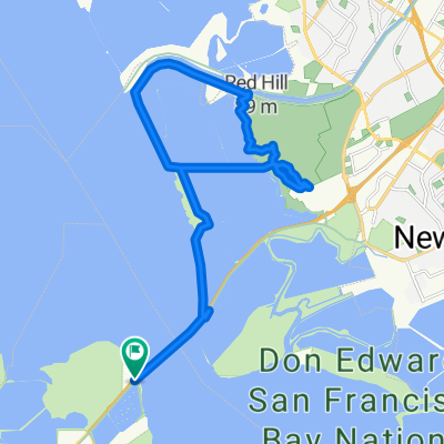
Overview
About this route
- 1 h 47 min
- Duration
- 35.3 km
- Distance
- 16 m
- Ascent
- 20 m
- Descent
- 19.8 km/h
- Avg. speed
- ---
- Max. altitude

Route photos

Route quality
Waytypes & surfaces along the route
Waytypes
Track
19.1 km
(54 %)
Cycleway
10.2 km
(29 %)
Surfaces
Paved
23.7 km
(67 %)
Unpaved
10.6 km
(30 %)
Asphalt
14.8 km
(42 %)
Ground
6.7 km
(19 %)
Continue with Bikemap
Use, edit, or download this cycling route
You would like to ride De Baylor Street 2529, East Palo Alto a Baylor Street 2536, East Palo Alto or customize it for your own trip? Here is what you can do with this Bikemap route:
Free features
- Save this route as favorite or in collections
- Copy & plan your own version of this route
- Sync your route with Garmin or Wahoo
Premium features
Free trial for 3 days, or one-time payment. More about Bikemap Premium.
- Navigate this route on iOS & Android
- Export a GPX / KML file of this route
- Create your custom printout (try it for free)
- Download this route for offline navigation
Discover more Premium features.
Get Bikemap PremiumFrom our community
Other popular routes starting in East Palo Alto
 City Street Riding 101 -- blue route
- Distance
- 8.9 km
- Ascent
- 10 m
- Descent
- 9 m
- Location
- East Palo Alto, California, United States
 Big Loop Arastradero + Portola Valley + Palo Alto
- Distance
- 37 km
- Ascent
- 297 m
- Descent
- 297 m
- Location
- East Palo Alto, California, United States
 8/26/2017 Newark-Facebook
- Distance
- 25.2 km
- Ascent
- 19 m
- Descent
- 13 m
- Location
- East Palo Alto, California, United States
 Dumbarton to Coyote Hills Loop
- Distance
- 27.7 km
- Ascent
- 81 m
- Descent
- 81 m
- Location
- East Palo Alto, California, United States
 kings mountain
- Distance
- 45.1 km
- Ascent
- 898 m
- Descent
- 888 m
- Location
- East Palo Alto, California, United States
 De Baylor Street 2529, East Palo Alto a Baylor Street 2536, East Palo Alto
- Distance
- 35.3 km
- Ascent
- 16 m
- Descent
- 20 m
- Location
- East Palo Alto, California, United States
 Dumbarton Loop
- Distance
- 29.7 km
- Ascent
- 41 m
- Descent
- 43 m
- Location
- East Palo Alto, California, United States
 Dumbarton Bridge
- Distance
- 19.9 km
- Ascent
- 12 m
- Descent
- 12 m
- Location
- East Palo Alto, California, United States
Open it in the app