

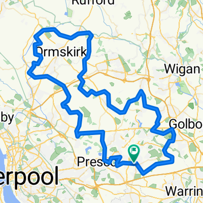
Route 1
A cycling route starting in St Helens, England, United Kingdom.
Overview
About this route
- 1 h 14 min
- Duration
- 20.7 km
- Distance
- 273 m
- Ascent
- 275 m
- Descent
- 16.7 km/h
- Avg. speed
- ---
- Max. altitude

Continue with Bikemap
Use, edit, or download this cycling route
You would like to ride Route 1 or customize it for your own trip? Here is what you can do with this Bikemap route:
Free features
- Save this route as favorite or in collections
- Copy & plan your own version of this route
- Sync your route with Garmin or Wahoo
Premium features
Free trial for 3 days, or one-time payment. More about Bikemap Premium.
- Navigate this route on iOS & Android
- Export a GPX / KML file of this route
- Create your custom printout (try it for free)
- Download this route for offline navigation
Discover more Premium features.
Get Bikemap PremiumFrom our community
Other popular routes starting in St Helens
 To Work
- Distance
- 33.6 km
- Ascent
- 81 m
- Descent
- 121 m
- Location
- St Helens, England, United Kingdom
 Hillsborough 96
- Distance
- 95.6 km
- Ascent
- 342 m
- Descent
- 344 m
- Location
- St Helens, England, United Kingdom
 Bickerstaffe Street (Stand B9) to Portico Lane
- Distance
- 4.3 km
- Ascent
- 100 m
- Descent
- 55 m
- Location
- St Helens, England, United Kingdom
 32 Bramcote Avenue, St. Helens to 34 Long Lane, Southport
- Distance
- 34.5 km
- Ascent
- 60 m
- Descent
- 100 m
- Location
- St Helens, England, United Kingdom
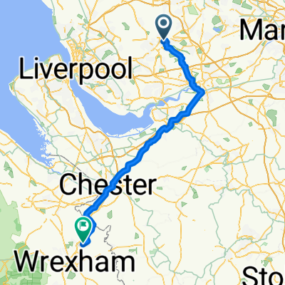 34 Bramcote Ave, St Helens to 82 Chester Road, Wrexham
- Distance
- 64.6 km
- Ascent
- 400 m
- Descent
- 369 m
- Location
- St Helens, England, United Kingdom
 crosby
- Distance
- 66.4 km
- Ascent
- 203 m
- Descent
- 208 m
- Location
- St Helens, England, United Kingdom
 9 Congress Gardens, St. Helens to 9 Congress Gardens, St. Helens
- Distance
- 11.8 km
- Ascent
- 116 m
- Descent
- 118 m
- Location
- St Helens, England, United Kingdom
 34 Birstall Ave, St Helens to Station Road, St Helens
- Distance
- 4.8 km
- Ascent
- 18 m
- Descent
- 11 m
- Location
- St Helens, England, United Kingdom
Open it in the app