

925 RIDEOUT #1
A cycling route starting in Brentwood, California, United States.
Overview
About this route
Ride to Old Imperial for drinks and food
- -:--
- Duration
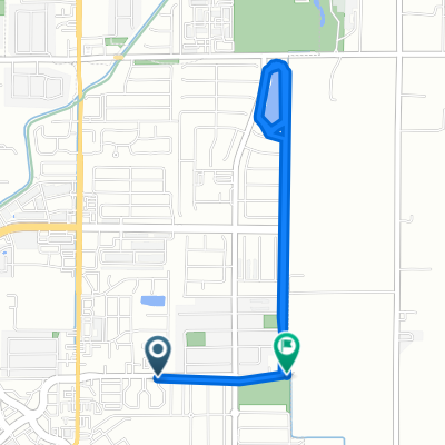
- 13.7 km
- Distance
- 13 m
- Ascent
- 13 m
- Descent
- ---
- Avg. speed
- ---
- Max. altitude

Route quality
Waytypes & surfaces along the route
Waytypes
Road
7.3 km
(53 %)
Cycleway
3.7 km
(27 %)
Surfaces
Paved
9.6 km
(70 %)
Asphalt
5.9 km
(43 %)
Paved (undefined)
3.7 km
(27 %)
Undefined
4.1 km
(30 %)
Route highlights
Points of interest along the route
Accommodation after 7.1 km
Have Drinks and Eat
Continue with Bikemap
Use, edit, or download this cycling route
You would like to ride 925 RIDEOUT #1 or customize it for your own trip? Here is what you can do with this Bikemap route:
Free features
- Save this route as favorite or in collections
- Copy & plan your own version of this route
- Sync your route with Garmin or Wahoo
Premium features
Free trial for 3 days, or one-time payment. More about Bikemap Premium.
- Navigate this route on iOS & Android
- Export a GPX / KML file of this route
- Create your custom printout (try it for free)
- Download this route for offline navigation
Discover more Premium features.
Get Bikemap PremiumFrom our community
Other popular routes starting in Brentwood
 Arbor Court 743, Brentwood to Mazant Loop 5397, Antioch
- Distance
- 13.8 km
- Ascent
- 30 m
- Descent
- 10 m
- Location
- Brentwood, California, United States
 127 Sycamore Ave, Brentwood to 3400 Wilbur Ave, Antioch
- Distance
- 15.9 km
- Ascent
- 17 m
- Descent
- 32 m
- Location
- Brentwood, California, United States
 Nottingham Drive 503, Brentwood to Balfour Road 2400, Brentwood
- Distance
- 8.3 km
- Ascent
- 65 m
- Descent
- 52 m
- Location
- Brentwood, California, United States
 Lone Oak Court 421, Brentwood to Fall Lane 4499, Oakley
- Distance
- 6.9 km
- Ascent
- 7 m
- Descent
- 18 m
- Location
- Brentwood, California, United States
 Sunday
- Distance
- 151.2 km
- Ascent
- 1,944 m
- Descent
- 1,941 m
- Location
- Brentwood, California, United States
 Safeway trip
- Distance
- 10.7 km
- Ascent
- 34 m
- Descent
- 20 m
- Location
- Brentwood, California, United States
 ddddddddddddddddddd
- Distance
- 45 km
- Ascent
- 610 m
- Descent
- 302 m
- Location
- Brentwood, California, United States
 Recovered Route
- Distance
- 12.3 km
- Ascent
- 9 m
- Descent
- 10 m
- Location
- Brentwood, California, United States
Open it in the app