
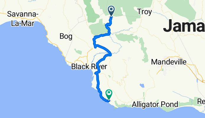
Unnamed Road, Accompong Maroon to Lewis Town Road, Treasure Beach
A cycling route starting in Maggotty, Saint Elizabeth, Jamaica.
Overview
About this route
- 3 h 45 min
- Duration
- 65 km
- Distance
- 827 m
- Ascent
- 1,245 m
- Descent
- 17.4 km/h
- Avg. speed
- ---
- Max. altitude

Route quality
Waytypes & surfaces along the route
Waytypes
Quiet road
31.4 km
(48 %)
Busy road
21.8 km
(34 %)
Surfaces
Paved
27.1 km
(42 %)
Asphalt
27.1 km
(42 %)
Undefined
37.9 km
(58 %)
Continue with Bikemap
Use, edit, or download this cycling route
You would like to ride Unnamed Road, Accompong Maroon to Lewis Town Road, Treasure Beach or customize it for your own trip? Here is what you can do with this Bikemap route:
Free features
- Save this route as favorite or in collections
- Copy & plan your own version of this route
- Sync your route with Garmin or Wahoo
Premium features
Free trial for 3 days, or one-time payment. More about Bikemap Premium.
- Navigate this route on iOS & Android
- Export a GPX / KML file of this route
- Create your custom printout (try it for free)
- Download this route for offline navigation
Discover more Premium features.
Get Bikemap PremiumFrom our community
Other popular routes starting in Maggotty
 Unnamed Road, Accompong Maroon to Lewis Town Road, Treasure Beach
- Distance
- 65 km
- Ascent
- 827 m
- Descent
- 1,245 m
- Location
- Maggotty, Saint Elizabeth, Jamaica
 Accompong - Treasure Beach
- Distance
- 65.2 km
- Ascent
- 293 m
- Descent
- 712 m
- Location
- Maggotty, Saint Elizabeth, Jamaica
 Bethsalem Road to A2, East Lacovia
- Distance
- 28.5 km
- Ascent
- 205 m
- Descent
- 537 m
- Location
- Maggotty, Saint Elizabeth, Jamaica
 Accompong - Mandeville
- Distance
- 92.9 km
- Ascent
- 1,448 m
- Descent
- 1,271 m
- Location
- Maggotty, Saint Elizabeth, Jamaica
 Accompong - Montego Bay
- Distance
- 60.8 km
- Ascent
- 625 m
- Descent
- 1,070 m
- Location
- Maggotty, Saint Elizabeth, Jamaica
Open it in the app