Pappenheim - 12 Apostel - Pappenheim Nr2
- 23.7 km
- 518 m
- 517 m
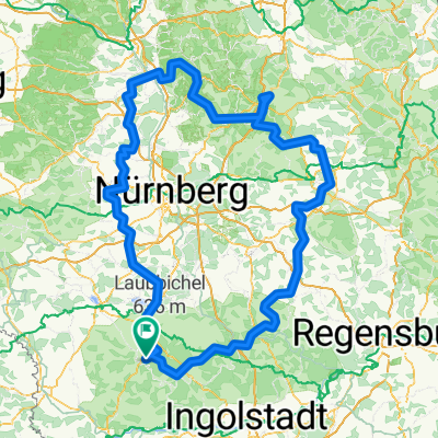
- Pappenheim, Bavaria, Germany
A cycling route starting in Pappenheim, Bavaria, Germany.
Overview
created this 14 years ago
Route quality
Road
107.8 km
(39 %)
Quiet road
38.7 km
(14 %)
Paved
193.5 km
(70 %)
Unpaved
8.3 km
(3 %)
Asphalt
176.9 km
(64 %)
Paved (undefined)
16.6 km
(6 %)
Route highlights
OMV Tankstelle Wertingen
Continue with Bikemap
You would like to ride Bayerrundfahrt 1200er or customize it for your own trip? Here is what you can do with this Bikemap route:
Free trial for 3 days, or one-time payment. More about Bikemap Premium.
Discover more Premium features.
Get Bikemap PremiumFrom our community
Open it in the app