

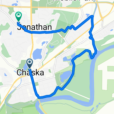
B2B00838 55318>55414 via SWLRT, Greenway, Cedar Lake Trl
A cycling route starting in Chaska, Minnesota, United States of America.
Overview
About this route
Return trip can take Hennepin (has bike lanes that run in both directions). Lanes terminate around Washington Av so will have to merge into traffic. Can take Hennepin to 11th St to get back to Cedar Lake trail.
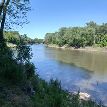
The SW LRT trail is compacted gravel trail which can be ridden on with a skinny tire as the gravel is not usually deep. The trail starts off of Flying Cloud Blvd and the entrance is not very obvious.
- -:--
- Duration
- 37.2 km
- Distance
- 136 m
- Ascent
- 159 m
- Descent
- ---
- Avg. speed
- ---
- Avg. speed
Route highlights
Points of interest along the route
Point of interest after 3 km
Gravel LRT trail starts
Point of interest after 22.3 km
Cross street to start of Greenway
Point of interest after 29.3 km
Exit to Kennilworth/Cedar Lake Trail
Point of interest after 31.2 km
Cedar Lake Trail Connection
Point of interest after 34.1 km
Cedar Lake Trail exit to Glenwood
Continue with Bikemap
Use, edit, or download this cycling route
You would like to ride B2B00838 55318>55414 via SWLRT, Greenway, Cedar Lake Trl or customize it for your own trip? Here is what you can do with this Bikemap route:
Free features
- Save this route as favorite or in collections
- Copy & plan your own version of this route
- Sync your route with Garmin or Wahoo
Premium features
Free trial for 3 days, or one-time payment. More about Bikemap Premium.
- Navigate this route on iOS & Android
- Export a GPX / KML file of this route
- Create your custom printout (try it for free)
- Download this route for offline navigation
Discover more Premium features.
Get Bikemap PremiumFrom our community
Other popular routes starting in Chaska
 Chaska to Bloomington at Ferry Bridge, round trip.
- Distance
- 39.3 km
- Ascent
- 88 m
- Descent
- 91 m
- Location
- Chaska, Minnesota, United States of America
 B2B00838 55318>55414 via SWLRT, Greenway, Cedar Lake Trl
- Distance
- 37.2 km
- Ascent
- 136 m
- Descent
- 159 m
- Location
- Chaska, Minnesota, United States of America
 Easy ride in Chaska
- Distance
- 16.1 km
- Ascent
- 138 m
- Descent
- 138 m
- Location
- Chaska, Minnesota, United States of America
 Short bike tour through Chaska
- Distance
- 7.1 km
- Ascent
- 44 m
- Descent
- 44 m
- Location
- Chaska, Minnesota, United States of America
 First trial for long route
- Distance
- 26.3 km
- Ascent
- 135 m
- Descent
- 133 m
- Location
- Chaska, Minnesota, United States of America
 3210 Chaska Blvd, Chaska to 300 Cardinal Ct, Chaska
- Distance
- 7 km
- Ascent
- 70 m
- Descent
- 19 m
- Location
- Chaska, Minnesota, United States of America
 De South Oak Street 317, Chaska a Darrick Road 204, Chaska
- Distance
- 7.2 km
- Ascent
- 123 m
- Descent
- 126 m
- Location
- Chaska, Minnesota, United States of America
 1st run to carver
- Distance
- 28.3 km
- Ascent
- 80 m
- Descent
- 43 m
- Location
- Chaska, Minnesota, United States of America
Open it in the app