

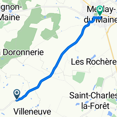
D610, Longuefuye to D109, Ruillé-Froid-Fonds
A cycling route starting in Meslay-du-Maine, Pays de la Loire Region, France.
Overview
About this route
- 51 min
- Duration
- 18.5 km
- Distance
- 135 m
- Ascent
- 161 m
- Descent
- 21.6 km/h
- Avg. speed
- ---
- Max. altitude

Route quality
Waytypes & surfaces along the route
Waytypes
Road
16.1 km
(87 %)
Quiet road
1.4 km
(7 %)
Surfaces
Paved
2.8 km
(15 %)
Asphalt
2.8 km
(15 %)
Undefined
15.7 km
(85 %)
Continue with Bikemap
Use, edit, or download this cycling route
You would like to ride D610, Longuefuye to D109, Ruillé-Froid-Fonds or customize it for your own trip? Here is what you can do with this Bikemap route:
Free features
- Save this route as favorite or in collections
- Copy & plan your own version of this route
- Sync your route with Garmin or Wahoo
Premium features
Free trial for 3 days, or one-time payment. More about Bikemap Premium.
- Navigate this route on iOS & Android
- Export a GPX / KML file of this route
- Create your custom printout (try it for free)
- Download this route for offline navigation
Discover more Premium features.
Get Bikemap PremiumFrom our community
Other popular routes starting in Meslay-du-Maine
 D109, Ruillé-Froid-Fonds to La Lézardière, Villiers-Charlemagne
- Distance
- 7.7 km
- Ascent
- 51 m
- Descent
- 41 m
- Location
- Meslay-du-Maine, Pays de la Loire Region, France
 Saint-Denis-du-Maine-Chateau-la-Vallière
- Distance
- 86.3 km
- Ascent
- 238 m
- Descent
- 230 m
- Location
- Meslay-du-Maine, Pays de la Loire Region, France
 D610, Longuefuye to D109, Ruillé-Froid-Fonds
- Distance
- 18.5 km
- Ascent
- 135 m
- Descent
- 161 m
- Location
- Meslay-du-Maine, Pays de la Loire Region, France
 Le Haut Mortier to Rue Raoul du Bouchet
- Distance
- 5.8 km
- Ascent
- 50 m
- Descent
- 37 m
- Location
- Meslay-du-Maine, Pays de la Loire Region, France
 Itinéraire vers 22 Route de Laval, Azé
- Distance
- 25.5 km
- Ascent
- 153 m
- Descent
- 212 m
- Location
- Meslay-du-Maine, Pays de la Loire Region, France
 Rue de Laval Bis to La Transoulière
- Distance
- 10.4 km
- Ascent
- 56 m
- Descent
- 103 m
- Location
- Meslay-du-Maine, Pays de la Loire Region, France
Open it in the app