

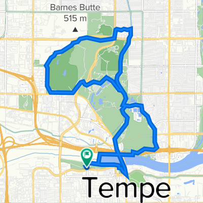
tempe-scottsdale-camelback
A cycling route starting in Tempe Junction, Arizona, United States.
Overview
About this route
tempe-scottsdale-camelback
- -:--
- Duration
- 49.1 km
- Distance
- 110 m
- Ascent
- 113 m
- Descent
- ---
- Avg. speed
- ---
- Max. altitude

Route quality
Waytypes & surfaces along the route
Waytypes
Cycleway
20.2 km
(41 %)
Road
10.8 km
(22 %)
Surfaces
Paved
45.2 km
(92 %)
Unpaved
2 km
(4 %)
Asphalt
25.6 km
(52 %)
Concrete
19.7 km
(40 %)
Continue with Bikemap
Use, edit, or download this cycling route
You would like to ride tempe-scottsdale-camelback or customize it for your own trip? Here is what you can do with this Bikemap route:
Free features
- Save this route as favorite or in collections
- Copy & plan your own version of this route
- Sync your route with Garmin or Wahoo
Premium features
Free trial for 3 days, or one-time payment. More about Bikemap Premium.
- Navigate this route on iOS & Android
- Export a GPX / KML file of this route
- Create your custom printout (try it for free)
- Download this route for offline navigation
Discover more Premium features.
Get Bikemap PremiumFrom our community
Other popular routes starting in Tempe Junction
 tempe-scottsdale-camelback
- Distance
- 49.1 km
- Ascent
- 110 m
- Descent
- 113 m
- Location
- Tempe Junction, Arizona, United States
 South Potato
- Distance
- 82.6 km
- Ascent
- 316 m
- Descent
- 316 m
- Location
- Tempe Junction, Arizona, United States
 Best of Papago, Mild
- Distance
- 18.4 km
- Ascent
- 176 m
- Descent
- 177 m
- Location
- Tempe Junction, Arizona, United States
 Tempe lake route 1
- Distance
- 6.8 km
- Ascent
- 69 m
- Descent
- 67 m
- Location
- Tempe Junction, Arizona, United States
 Best of Papago, Spicy
- Distance
- 18.1 km
- Ascent
- 203 m
- Descent
- 205 m
- Location
- Tempe Junction, Arizona, United States
 North Potato
- Distance
- 76.6 km
- Ascent
- 346 m
- Descent
- 346 m
- Location
- Tempe Junction, Arizona, United States
 western canal
- Distance
- 34.7 km
- Ascent
- 28 m
- Descent
- 28 m
- Location
- Tempe Junction, Arizona, United States
 Mesa Half Metric
- Distance
- 50 km
- Ascent
- 271 m
- Descent
- 271 m
- Location
- Tempe Junction, Arizona, United States
Open it in the app