

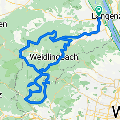
AUT KLBG-Dopplerhütte-Greifenstein-Weinviertel-KLBG
A cycling route starting in Klosterneuburg, Lower Austria, Austria.
Overview
About this route
Gute Trainingsrunde für RR. Großteil im GA-Bereich fahrbar, aber doch ein paar Bergerl mittendrin. KLBG bis Steinriegl ist zäher als man auf der Karte vermuten würde.Donauinsel am Wochenende unbedingt meiden.
- -:--
- Duration
- 68.8 km
- Distance
- 652 m
- Ascent
- 661 m
- Descent
- ---
- Avg. speed
- 467 m
- Max. altitude

Route quality
Waytypes & surfaces along the route
Waytypes
Busy road
24.4 km
(35 %)
Cycleway
21.7 km
(31 %)
Surfaces
Paved
60 km
(87 %)
Unpaved
1.8 km
(3 %)
Asphalt
58.2 km
(85 %)
Ground
1.6 km
(2 %)
Continue with Bikemap
Use, edit, or download this cycling route
You would like to ride AUT KLBG-Dopplerhütte-Greifenstein-Weinviertel-KLBG or customize it for your own trip? Here is what you can do with this Bikemap route:
Free features
- Save this route as favorite or in collections
- Copy & plan your own version of this route
- Sync your route with Garmin or Wahoo
Premium features
Free trial for 3 days, or one-time payment. More about Bikemap Premium.
- Navigate this route on iOS & Android
- Export a GPX / KML file of this route
- Create your custom printout (try it for free)
- Download this route for offline navigation
Discover more Premium features.
Get Bikemap PremiumFrom our community
Other popular routes starting in Klosterneuburg
 120_Donauinsel-Kreutal-Spannberg-Donauinsel
- Distance
- 119.8 km
- Ascent
- 393 m
- Descent
- 403 m
- Location
- Klosterneuburg, Lower Austria, Austria
 Weidling - Rieglerhütte - Weidling
- Distance
- 24 km
- Ascent
- 684 m
- Descent
- 685 m
- Location
- Klosterneuburg, Lower Austria, Austria
 KLBG-Tulln-Kreuzenstein
- Distance
- 83.3 km
- Ascent
- 690 m
- Descent
- 700 m
- Location
- Klosterneuburg, Lower Austria, Austria
 Höhenstraßen - Marathon (Wien)
- Distance
- 95.2 km
- Ascent
- 2,035 m
- Descent
- 1,947 m
- Location
- Klosterneuburg, Lower Austria, Austria
 Klosterneuburg Loudonsche Türkensteine Mostalm
- Distance
- 51.2 km
- Ascent
- 913 m
- Descent
- 913 m
- Location
- Klosterneuburg, Lower Austria, Austria
 Home - Dreamland
- Distance
- 11.4 km
- Ascent
- 391 m
- Descent
- 316 m
- Location
- Klosterneuburg, Lower Austria, Austria
 Babenbergerstrecke bis Windischhütte
- Distance
- 18.4 km
- Ascent
- 442 m
- Descent
- 442 m
- Location
- Klosterneuburg, Lower Austria, Austria
 Radrunde von Klosterneuburg nach Wien
- Distance
- 22.4 km
- Ascent
- 417 m
- Descent
- 413 m
- Location
- Klosterneuburg, Lower Austria, Austria
Open it in the app