

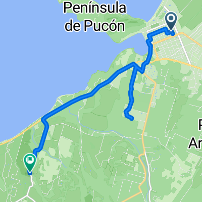
De Camino Internacional 1865, Pucón a Pedro de Valdivia 648, Pucón
A cycling route starting in Pucón, Región de la Araucanía, Chile.
Overview
About this route
- 3 h 53 min
- Duration
- 36.4 km
- Distance
- 512 m
- Ascent
- 521 m
- Descent
- 9.4 km/h
- Avg. speed
- ---
- Max. altitude

Route photos


Route quality
Waytypes & surfaces along the route
Waytypes
Road
14.9 km
(41 %)
Cycleway
4 km
(11 %)
Surfaces
Paved
30.2 km
(83 %)
Unpaved
6.2 km
(17 %)
Paved (undefined)
19.3 km
(53 %)
Asphalt
8 km
(22 %)
Continue with Bikemap
Use, edit, or download this cycling route
You would like to ride De Camino Internacional 1865, Pucón a Pedro de Valdivia 648, Pucón or customize it for your own trip? Here is what you can do with this Bikemap route:
Free features
- Save this route as favorite or in collections
- Copy & plan your own version of this route
- Sync your route with Garmin or Wahoo
Premium features
Free trial for 3 days, or one-time payment. More about Bikemap Premium.
- Navigate this route on iOS & Android
- Export a GPX / KML file of this route
- Create your custom printout (try it for free)
- Download this route for offline navigation
Discover more Premium features.
Get Bikemap PremiumFrom our community
Other popular routes starting in Pucón
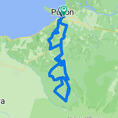
 Descenso volcan villarica a Pucón (pizza cala)
- Distance
- 18.1 km
- Ascent
- 81 m
- Descent
- 1,262 m
- Location
- Pucón, Región de la Araucanía, Chile
 Pucón - V. La Angostura
- Distance
- 404.3 km
- Ascent
- 2,218 m
- Descent
- 1,645 m
- Location
- Pucón, Región de la Araucanía, Chile
 -39.274, -71.973 to -39.309, -72.015
- Distance
- 11 km
- Ascent
- 321 m
- Descent
- 210 m
- Location
- Pucón, Región de la Araucanía, Chile
 Domingo 10 Libre en Pucón
- Distance
- 63.4 km
- Ascent
- 519 m
- Descent
- 519 m
- Location
- Pucón, Región de la Araucanía, Chile
 Etapa 5
- Distance
- 40.3 km
- Ascent
- 1,106 m
- Descent
- 1,100 m
- Location
- Pucón, Región de la Araucanía, Chile
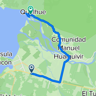 Variante Internacional 1415, Pucón a S-919, Pucón
- Distance
- 13.1 km
- Ascent
- 155 m
- Descent
- 162 m
- Location
- Pucón, Región de la Araucanía, Chile
 RUta xtream paque Nacional Huerquehue
- Distance
- 41.6 km
- Ascent
- 669 m
- Descent
- 666 m
- Location
- Pucón, Región de la Araucanía, Chile
 Lake District 7. Etappe Termas de Palguin - Villarrica
- Distance
- 47.5 km
- Ascent
- 181 m
- Descent
- 971 m
- Location
- Pucón, Región de la Araucanía, Chile
Open it in the app