

The Malt Barn, Marton Road, Rugby to 1 High Town, Rugby
A cycling route starting in Long Itchington, England, United Kingdom.
Overview
About this route
- 18 min
- Duration
- 5.1 km
- Distance
- 27 m
- Ascent
- 29 m
- Descent
- 16.9 km/h
- Avg. speed
- ---
- Max. altitude
Continue with Bikemap
Use, edit, or download this cycling route
You would like to ride The Malt Barn, Marton Road, Rugby to 1 High Town, Rugby or customize it for your own trip? Here is what you can do with this Bikemap route:
Free features
- Save this route as favorite or in collections
- Copy & plan your own version of this route
- Sync your route with Garmin or Wahoo
Premium features
Free trial for 3 days, or one-time payment. More about Bikemap Premium.
- Navigate this route on iOS & Android
- Export a GPX / KML file of this route
- Create your custom printout (try it for free)
- Download this route for offline navigation
Discover more Premium features.
Get Bikemap PremiumFrom our community
Other popular routes starting in Long Itchington
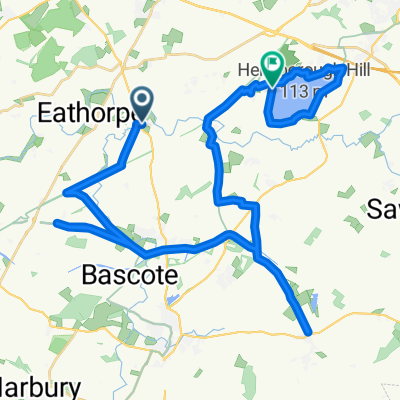
 Marton, Birdingbury and Long Itchington Loop
- Distance
- 15.3 km
- Ascent
- 62 m
- Descent
- 63 m
- Location
- Long Itchington, England, United Kingdom
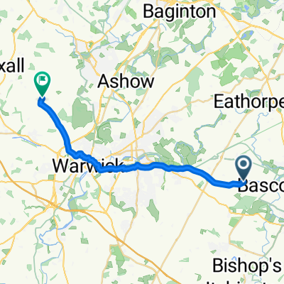
 Calias Lane, Rugby to Asta Court, Chestnut Field, Rugby
- Distance
- 26 km
- Ascent
- 276 m
- Descent
- 258 m
- Location
- Long Itchington, England, United Kingdom
 Lambert route
- Distance
- 40 km
- Ascent
- 218 m
- Descent
- 196 m
- Location
- Long Itchington, England, United Kingdom
 Odingsel Drive 7, Long Itchington to Mount Pleasant Unit 7
- Distance
- 70.1 km
- Ascent
- 493 m
- Descent
- 420 m
- Location
- Long Itchington, England, United Kingdom
 From Southam to Warwick
- Distance
- 17.7 km
- Ascent
- 70 m
- Descent
- 46 m
- Location
- Long Itchington, England, United Kingdom
 Leamington Spa to Limestone Hall Lane
- Distance
- 25 km
- Ascent
- 201 m
- Descent
- 212 m
- Location
- Long Itchington, England, United Kingdom
 globes birthday bike ride
- Distance
- 56.5 km
- Ascent
- 239 m
- Descent
- 268 m
- Location
- Long Itchington, England, United Kingdom
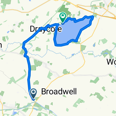 Around Draycote Water
- Distance
- 14.7 km
- Ascent
- 85 m
- Descent
- 83 m
- Location
- Long Itchington, England, United Kingdom
Open it in the app