

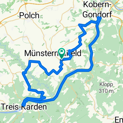
Maifeld-Mosel-Runde
A cycling route starting in Münstermaifeld, Rhineland-Palatinate, Germany.
Overview
About this route
On the way across the Maifeld and along the Moselle
- -:--
- Duration
- 25.8 km
- Distance
- 463 m
- Ascent
- 457 m
- Descent
- ---
- Avg. speed
- 285 m
- Max. altitude
Route quality
Waytypes & surfaces along the route
Waytypes
Road
10.1 km
(39 %)
Track
6.5 km
(25 %)
Surfaces
Paved
22.7 km
(88 %)
Asphalt
16.8 km
(65 %)
Paved (undefined)
5.9 km
(23 %)
Undefined
3.1 km
(12 %)
Continue with Bikemap
Use, edit, or download this cycling route
You would like to ride Maifeld-Mosel-Runde or customize it for your own trip? Here is what you can do with this Bikemap route:
Free features
- Save this route as favorite or in collections
- Copy & plan your own version of this route
- Sync your route with Garmin or Wahoo
Premium features
Free trial for 3 days, or one-time payment. More about Bikemap Premium.
- Navigate this route on iOS & Android
- Export a GPX / KML file of this route
- Create your custom printout (try it for free)
- Download this route for offline navigation
Discover more Premium features.
Get Bikemap PremiumFrom our community
Other popular routes starting in Münstermaifeld
 Münstermeifeld-Bernkastel
- Distance
- 88.2 km
- Ascent
- 472 m
- Descent
- 577 m
- Location
- Münstermaifeld, Rhineland-Palatinate, Germany
 Münstermaifeld - Blankenheimerdorf
- Distance
- 89 km
- Ascent
- 814 m
- Descent
- 528 m
- Location
- Münstermaifeld, Rhineland-Palatinate, Germany
 Münstermaifeld - Burg Eltz
- Distance
- 5.8 km
- Ascent
- 41 m
- Descent
- 162 m
- Location
- Münstermaifeld, Rhineland-Palatinate, Germany
 Maifeld-Mosel-Runde 2 270808
- Distance
- 57 km
- Ascent
- 676 m
- Descent
- 687 m
- Location
- Münstermaifeld, Rhineland-Palatinate, Germany
 Rundfahrt um die Burg Eltz
- Distance
- 21.8 km
- Ascent
- 294 m
- Descent
- 294 m
- Location
- Münstermaifeld, Rhineland-Palatinate, Germany
 Maifeld-Mosel-Runde
- Distance
- 25.8 km
- Ascent
- 463 m
- Descent
- 457 m
- Location
- Münstermaifeld, Rhineland-Palatinate, Germany
 Eltz 1
- Distance
- 20.8 km
- Ascent
- 313 m
- Descent
- 327 m
- Location
- Münstermaifeld, Rhineland-Palatinate, Germany
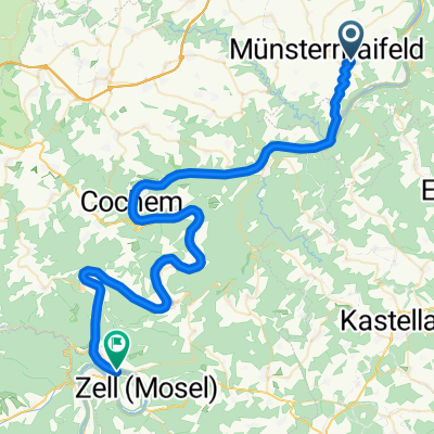 Münstermaifeld - Zell
- Distance
- 56.9 km
- Ascent
- 542 m
- Descent
- 663 m
- Location
- Münstermaifeld, Rhineland-Palatinate, Germany
Open it in the app