

TOUR DE CSÁKVÁR 2021
VÉRTES Országúti Maraton RT70
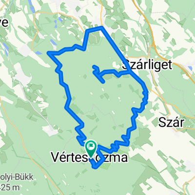
A cycling route starting in Csákvár, Fejér, Hungary.
Overview
About this route
- -:--
- Duration
- 87.7 km
- Distance
- 481 m
- Ascent
- 481 m
- Descent
- ---
- Avg. speed
- 297 m
- Max. altitude
Part of
TOUR DE CSÁKVÁR 2021
3 stages
Route quality
Waytypes & surfaces along the route
Waytypes
Quiet road
7.9 km
(9 %)
Track
7 km
(8 %)
Surfaces
Paved
39.5 km
(45 %)
Unpaved
4.4 km
(5 %)
Asphalt
39.5 km
(45 %)
Ground
3.5 km
(4 %)
Route highlights
Points of interest along the route
Point of interest after 36.9 km
FRISSÍTŐPONT
Continue with Bikemap
Use, edit, or download this cycling route
You would like to ride VÉRTES Országúti Maraton RT70 or customize it for your own trip? Here is what you can do with this Bikemap route:
Free features
- Save this route as favorite or in collections
- Copy & plan your own version of this route
- Split it into stages to create a multi-day tour
- Sync your route with Garmin or Wahoo
Premium features
Free trial for 3 days, or one-time payment. More about Bikemap Premium.
- Navigate this route on iOS & Android
- Export a GPX / KML file of this route
- Create your custom printout (try it for free)
- Download this route for offline navigation
Discover more Premium features.
Get Bikemap PremiumFrom our community
Other popular routes starting in Csákvár
 Vérteskozma - Tatabánya
- Distance
- 40.5 km
- Ascent
- 415 m
- Descent
- 410 m
- Location
- Csákvár, Fejér, Hungary
 Vértesi Kerekezés 70K
- Distance
- 61.3 km
- Ascent
- 536 m
- Descent
- 544 m
- Location
- Csákvár, Fejér, Hungary
 Eventoplena IX
- Distance
- 93.7 km
- Ascent
- 478 m
- Descent
- 482 m
- Location
- Csákvár, Fejér, Hungary
 vérteskozma 2015
- Distance
- 48.4 km
- Ascent
- 558 m
- Descent
- 558 m
- Location
- Csákvár, Fejér, Hungary
 Eventoplena III
- Distance
- 60.8 km
- Ascent
- 402 m
- Descent
- 402 m
- Location
- Csákvár, Fejér, Hungary
 MTB piknik 2011 CLONED FROM ROUTE 1070897
- Distance
- 53.6 km
- Ascent
- 737 m
- Descent
- 737 m
- Location
- Csákvár, Fejér, Hungary
 Eventoplena I
- Distance
- 13.4 km
- Ascent
- 190 m
- Descent
- 178 m
- Location
- Csákvár, Fejér, Hungary
 Long bike tour through Csákvár
- Distance
- 31.5 km
- Ascent
- 433 m
- Descent
- 431 m
- Location
- Csákvár, Fejér, Hungary
Open it in the app