

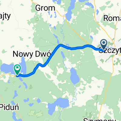
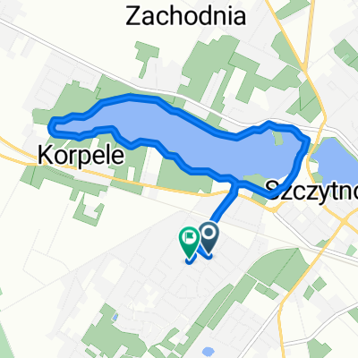
Szczytno - Dzwierzuty - Stare Kiejkuty - Szczytno
A cycling route starting in Szczytno, Warmian-Masurian Voivodeship, Poland.
Overview
About this route
Szczytno, Linowo, Dzwierzuty, Targowo, Orzyny, Mietkie, Marksewo, Stare Kiejkuty, Lemany, Szczytno
- -:--
- Duration
- 53.4 km
- Distance
- 120 m
- Ascent
- 123 m
- Descent
- ---
- Avg. speed
- 169 m
- Max. altitude

Route quality
Waytypes & surfaces along the route
Waytypes
Road
10.7 km
(20 %)
Quiet road
8.5 km
(16 %)
Surfaces
Paved
37.4 km
(70 %)
Unpaved
2.1 km
(4 %)
Asphalt
31.5 km
(59 %)
Paved (undefined)
5.9 km
(11 %)
Continue with Bikemap
Use, edit, or download this cycling route
You would like to ride Szczytno - Dzwierzuty - Stare Kiejkuty - Szczytno or customize it for your own trip? Here is what you can do with this Bikemap route:
Free features
- Save this route as favorite or in collections
- Copy & plan your own version of this route
- Sync your route with Garmin or Wahoo
Premium features
Free trial for 3 days, or one-time payment. More about Bikemap Premium.
- Navigate this route on iOS & Android
- Export a GPX / KML file of this route
- Create your custom printout (try it for free)
- Download this route for offline navigation
Discover more Premium features.
Get Bikemap PremiumFrom our community
Other popular routes starting in Szczytno
 Szczytno - Olsztyn
- Distance
- 62.8 km
- Ascent
- 180 m
- Descent
- 219 m
- Location
- Szczytno, Warmian-Masurian Voivodeship, Poland
 1. Szczytno - Spychowo
- Distance
- 31.8 km
- Ascent
- 134 m
- Descent
- 140 m
- Location
- Szczytno, Warmian-Masurian Voivodeship, Poland
 ride from Szczytno to Jedwabno
- Distance
- 13.6 km
- Ascent
- 86 m
- Descent
- 97 m
- Location
- Szczytno, Warmian-Masurian Voivodeship, Poland
 trasa 16.05.2018
- Distance
- 63 km
- Ascent
- 511 m
- Descent
- 513 m
- Location
- Szczytno, Warmian-Masurian Voivodeship, Poland
 Wakacyjny rajd rowerowy
- Distance
- 262.6 km
- Ascent
- 208 m
- Descent
- 226 m
- Location
- Szczytno, Warmian-Masurian Voivodeship, Poland
 Mazury ride part 2
- Distance
- 87.9 km
- Ascent
- 211 m
- Descent
- 214 m
- Location
- Szczytno, Warmian-Masurian Voivodeship, Poland
 Zrelaksowana trasa w Szczytno
- Distance
- 23.5 km
- Ascent
- 1,109 m
- Descent
- 1,108 m
- Location
- Szczytno, Warmian-Masurian Voivodeship, Poland
 Długa, Szczytno do Długa, Szczytno
- Distance
- 6.9 km
- Ascent
- 33 m
- Descent
- 29 m
- Location
- Szczytno, Warmian-Masurian Voivodeship, Poland
Open it in the app