
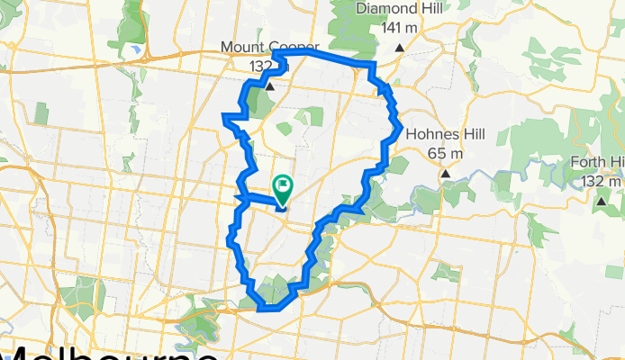
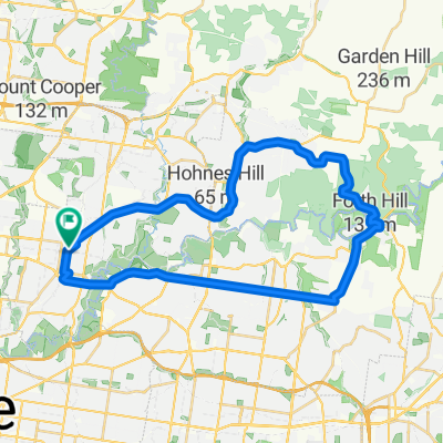
Heidelberg/Greensborough Bike Path Loop
A cycling route starting in Heidelberg Heights, Victoria, Australia.
Overview
About this route
- -:--
- Duration
- 44.7 km
- Distance
- 331 m
- Ascent
- 332 m
- Descent
- ---
- Avg. speed
- 126 m
- Max. altitude

Route quality
Waytypes & surfaces along the route
Waytypes
Cycleway
34.1 km
(76 %)
Quiet road
7.7 km
(17 %)
Surfaces
Paved
35.8 km
(80 %)
Unpaved
4.6 km
(10 %)
Concrete
19.8 km
(44 %)
Asphalt
10.7 km
(24 %)
Continue with Bikemap
Use, edit, or download this cycling route
You would like to ride Heidelberg/Greensborough Bike Path Loop or customize it for your own trip? Here is what you can do with this Bikemap route:
Free features
- Save this route as favorite or in collections
- Copy & plan your own version of this route
- Sync your route with Garmin or Wahoo
Premium features
Free trial for 3 days, or one-time payment. More about Bikemap Premium.
- Navigate this route on iOS & Android
- Export a GPX / KML file of this route
- Create your custom printout (try it for free)
- Download this route for offline navigation
Discover more Premium features.
Get Bikemap PremiumFrom our community
Other popular routes starting in Heidelberg Heights
 Merri Creek Trail Loop
- Distance
- 51.2 km
- Ascent
- 286 m
- Descent
- 288 m
- Location
- Heidelberg Heights, Victoria, Australia
 34 Wewak Parade, Heidelberg West to 25–35 John Street, Hawthorn
- Distance
- 11.3 km
- Ascent
- 60 m
- Descent
- 80 m
- Location
- Heidelberg Heights, Victoria, Australia
 Rosanna / Eltham / Warrandyte Loop
- Distance
- 40.5 km
- Ascent
- 356 m
- Descent
- 353 m
- Location
- Heidelberg Heights, Victoria, Australia
 Work Route
- Distance
- 5.7 km
- Ascent
- 36 m
- Descent
- 19 m
- Location
- Heidelberg Heights, Victoria, Australia
 Plenty gorge loop
- Distance
- 33.2 km
- Ascent
- 230 m
- Descent
- 224 m
- Location
- Heidelberg Heights, Victoria, Australia
 Southern Road 111, Heidelberg West to Greenbelt Avenue 4, Preston
- Distance
- 9.1 km
- Ascent
- 49 m
- Descent
- 59 m
- Location
- Heidelberg Heights, Victoria, Australia
 Hberg route
- Distance
- 19.2 km
- Ascent
- 129 m
- Descent
- 129 m
- Location
- Heidelberg Heights, Victoria, Australia
 Moderate route in
- Distance
- 19.3 km
- Ascent
- 126 m
- Descent
- 134 m
- Location
- Heidelberg Heights, Victoria, Australia
Open it in the app