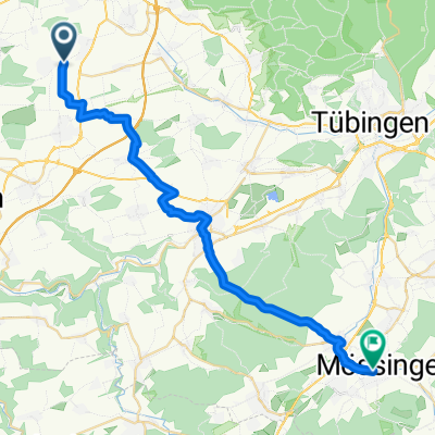
LLCBC
LILA LOGISTIK Charity Bike Cup - Gäufelden Öschelbronn
A cycling route starting in Unterjettingen, Baden-Wurttemberg, Germany.
Overview
About this route
On October 3, 2021, the LILA LOGISTIK Charity Bike Cup will be hosted for the first time in Gäufelden-Öschelbronn. The LILA RACE covers 6 laps of 13 km each, with a total length of 80 km. The LILA Tour consists of 4 laps of 13 km each, with a total length of 52 km.
- -:--
- Duration
- 12.9 km
- Distance
- 144 m
- Ascent
- 144 m
- Descent
- ---
- Avg. speed
- 555 m
- Max. altitude
Part of
LLCBC
1 stage
Route quality
Waytypes & surfaces along the route
Waytypes
Road
9.7 km
(75 %)
Quiet road
2.1 km
(16 %)
Surfaces
Paved
11.6 km
(90 %)
Asphalt
11.6 km
(90 %)
Undefined
1.3 km
(10 %)
Route highlights
Points of interest along the route
Drinking water after 8.5 km
Verpflegungsstelle
Point of interest after 12.9 km
RACE OFFICE
Continue with Bikemap
Use, edit, or download this cycling route
You would like to ride LILA LOGISTIK Charity Bike Cup - Gäufelden Öschelbronn or customize it for your own trip? Here is what you can do with this Bikemap route:
Free features
- Save this route as favorite or in collections
- Copy & plan your own version of this route
- Sync your route with Garmin or Wahoo
Premium features
Free trial for 3 days, or one-time payment. More about Bikemap Premium.
- Navigate this route on iOS & Android
- Export a GPX / KML file of this route
- Create your custom printout (try it for free)
- Download this route for offline navigation
Discover more Premium features.
Get Bikemap PremiumFrom our community
Other popular routes starting in Unterjettingen
- LILA LOGISTIK Charity Bike Cup - Gäufelden Öschelbronn
- Distance
- 12.9 km
- Ascent
- 144 m
- Descent
- 144 m
- Location
- Unterjettingen, Baden-Wurttemberg, Germany
- Gaeufelder Lauf 2018 (2)
- Distance
- 7.8 km
- Ascent
- 79 m
- Descent
- 78 m
- Location
- Unterjettingen, Baden-Wurttemberg, Germany
- Rundreise Gäu
- Distance
- 23.6 km
- Ascent
- 229 m
- Descent
- 249 m
- Location
- Unterjettingen, Baden-Wurttemberg, Germany
- Schönbuch-Rundfahrt_Juli-2011
- Distance
- 56.1 km
- Ascent
- 597 m
- Descent
- 586 m
- Location
- Unterjettingen, Baden-Wurttemberg, Germany
- Gäufelden-Binsdorf
- Distance
- 61.2 km
- Ascent
- 631 m
- Descent
- 519 m
- Location
- Unterjettingen, Baden-Wurttemberg, Germany
- von Gäufelden-Öschelbronn nach Mötzingen
- Distance
- 4.9 km
- Ascent
- 60 m
- Descent
- 26 m
- Location
- Unterjettingen, Baden-Wurttemberg, Germany
- Bebenhausen
- Distance
- 52 km
- Ascent
- 496 m
- Descent
- 501 m
- Location
- Unterjettingen, Baden-Wurttemberg, Germany
- Kleine Gäurunde
- Distance
- 20.8 km
- Ascent
- 187 m
- Descent
- 186 m
- Location
- Unterjettingen, Baden-Wurttemberg, Germany
Open it in the app