

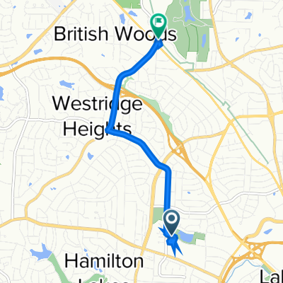
2906 Battleground Ave, Greensboro to 2601 Lawndale Dr, Greensboro
A cycling route starting in Greensboro, North Carolina, United States.
Overview
About this route
- 1 h 26 min
- Duration
- 17.9 km
- Distance
- 831 m
- Ascent
- 845 m
- Descent
- 12.4 km/h
- Avg. speed
- ---
- Max. altitude
Continue with Bikemap
Use, edit, or download this cycling route
You would like to ride 2906 Battleground Ave, Greensboro to 2601 Lawndale Dr, Greensboro or customize it for your own trip? Here is what you can do with this Bikemap route:
Free features
- Save this route as favorite or in collections
- Copy & plan your own version of this route
- Sync your route with Garmin or Wahoo
Premium features
Free trial for 3 days, or one-time payment. More about Bikemap Premium.
- Navigate this route on iOS & Android
- Export a GPX / KML file of this route
- Create your custom printout (try it for free)
- Download this route for offline navigation
Discover more Premium features.
Get Bikemap PremiumFrom our community
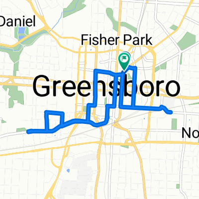
Other popular routes starting in Greensboro
 pooploop
- Distance
- 10.3 km
- Ascent
- 54 m
- Descent
- 70 m
- Location
- Greensboro, North Carolina, United States
 3358 W Friendly Ave, Greensboro to 3384–3398 Old Battleground Rd, Greensboro
- Distance
- 6.2 km
- Ascent
- 805 m
- Descent
- 771 m
- Location
- Greensboro, North Carolina, United States
 Spokes & Votes Route
- Distance
- 8.4 km
- Ascent
- 77 m
- Descent
- 76 m
- Location
- Greensboro, North Carolina, United States
 Daily
Daily- Distance
- 13.7 km
- Ascent
- 78 m
- Descent
- 106 m
- Location
- Greensboro, North Carolina, United States
 4308 Yanceyville Rd, Browns Summit to 4308 Yanceyville Rd, Browns Summit
- Distance
- 23.1 km
- Ascent
- 261 m
- Descent
- 260 m
- Location
- Greensboro, North Carolina, United States
 Restful route in Greensboro
- Distance
- 39.3 km
- Ascent
- 383 m
- Descent
- 383 m
- Location
- Greensboro, North Carolina, United States
 Latham Rd, Greensboro to Latham Rd, Greensboro
- Distance
- 5.7 km
- Ascent
- 193 m
- Descent
- 194 m
- Location
- Greensboro, North Carolina, United States
 North GSO 30
- Distance
- 48.7 km
- Ascent
- 230 m
- Descent
- 217 m
- Location
- Greensboro, North Carolina, United States
Open it in the app