

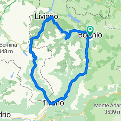
Bormio - Passo del Mortirolo
A cycling route starting in Bormio, Lombardy, Italy.
Overview
About this route
The Mortirolo Pass is opened to traffic only in summertime, from May to September. It connects the two provinces Sondrio and Brescia and is a particular challenge to bikers, who prove their power on this steep Alpine pass.
In order to reach Mazzo di Valtellina (the starting point of this pass) follow the route SS38; south direction (follow the signs for Sondrio. Please pay attention just outside Bormio; the SS38 enters long & dark tunnels very dangerous for bikers. Keep the right side please and follow the signs for Cepina. This is the old SS38 and will gently conduct you to Mazzo di Tirano (near Tirano).
Since the old SS38 and Mortirolo are secondary roads, traffic is not too bad. Right passed Mazzo you find soon a very steep uphill stretch. After that, the road will lead constantly uphill through the woods, untill you reach a tiny village. Passed that, the road gets steeper again and you drive uphill again surrounded by trees. Only a few parts of the road are not in the wood, which you leave just before getting to the top. On the Mortirolo Pass you find a wonderful panorama of the surrounding valleys and mountains
- -:--
- Duration
- 43.7 km
- Distance
- 1,407 m
- Ascent
- 782 m
- Descent
- ---
- Avg. speed
- ---
- Max. altitude

Route quality
Waytypes & surfaces along the route
Waytypes
Road
12.7 km
(29 %)
Quiet road
4.4 km
(10 %)
Surfaces
Paved
38.9 km
(89 %)
Unpaved
0.4 km
(1 %)
Asphalt
38.9 km
(89 %)
Gravel
0.4 km
(1 %)
Undefined
4.4 km
(10 %)
Continue with Bikemap
Use, edit, or download this cycling route
You would like to ride Bormio - Passo del Mortirolo or customize it for your own trip? Here is what you can do with this Bikemap route:
Free features
- Save this route as favorite or in collections
- Copy & plan your own version of this route
- Sync your route with Garmin or Wahoo
Premium features
Free trial for 3 days, or one-time payment. More about Bikemap Premium.
- Navigate this route on iOS & Android
- Export a GPX / KML file of this route
- Create your custom printout (try it for free)
- Download this route for offline navigation
Discover more Premium features.
Get Bikemap PremiumFrom our community
Other popular routes starting in Bormio
 Stelvio
- Distance
- 99 km
- Ascent
- 3,050 m
- Descent
- 3,029 m
- Location
- Bormio, Lombardy, Italy
 Alps 2016 - Day 1
- Distance
- 114.7 km
- Ascent
- 2,981 m
- Descent
- 2,981 m
- Location
- Bormio, Lombardy, Italy
 Alpencross 2008 - Etappe 5
- Distance
- 94.1 km
- Ascent
- 1,670 m
- Descent
- 2,426 m
- Location
- Bormio, Lombardy, Italy
 Pablo and Cloud
- Distance
- 55.8 km
- Ascent
- 1,855 m
- Descent
- 1,855 m
- Location
- Bormio, Lombardy, Italy
 Tour > Bormio - Tirano - Forcola di Livigno - Livigno - Bormio
- Distance
- 123.4 km
- Ascent
- 2,308 m
- Descent
- 2,313 m
- Location
- Bormio, Lombardy, Italy
 Bormio-Mortirolo-Bormio
- Distance
- 77.2 km
- Ascent
- 1,817 m
- Descent
- 1,817 m
- Location
- Bormio, Lombardy, Italy
 4. Etapa - BRM-Livigno-P.Bernina-Zemez-Umbrailpass-BRM
- Distance
- 171 km
- Ascent
- 3,493 m
- Descent
- 3,497 m
- Location
- Bormio, Lombardy, Italy
 Bormio - Passo Gavia - Bormio
- Distance
- 51.3 km
- Ascent
- 1,415 m
- Descent
- 1,414 m
- Location
- Bormio, Lombardy, Italy
Open it in the app