

Uni Essen, Rheinbahn, Wasserroute
A cycling route starting in Gelsenkirchen, North Rhine-Westphalia, Germany.
Overview
About this route
über Erzbahntrasse, Wanner-Kraybahn, Uni Essen, Rheinbahn bis jetzige Bauende, Grugaweg bis Essen-Stelle, Ruhrtalweg nach Dahlhausen, über R25 nach Hause.
- -:--
- Duration
- 54.2 km
- Distance
- 204 m
- Ascent
- 201 m
- Descent
- ---
- Avg. speed
- ---
- Avg. speed
Route quality
Waytypes & surfaces along the route
Waytypes
Path
29 km
(54 %)
Quiet road
7.8 km
(14 %)
Surfaces
Paved
45.7 km
(84 %)
Unpaved
6.4 km
(12 %)
Asphalt
41.3 km
(76 %)
Gravel
6.2 km
(11 %)
Route highlights
Points of interest along the route
Point of interest after 8.5 km
Abbiegen zur Uni
Point of interest after 14.8 km
Start der Rheinbahn
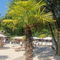
Photo after 16.4 km
bild 1+2
Photo after 17.2 km
Bild 3+4
Point of interest after 20.3 km
jetzige Ende Rheinbahn
Point of interest after 20.7 km
Grugaweg
Point of interest after 35 km
Ruhrtalweg
Point of interest after 39.9 km
R25
Point of interest after 51.8 km
Wanner-Kray-Bahn
Point of interest after 52.9 km
Erzbahntrasse
Continue with Bikemap
Use, edit, or download this cycling route
You would like to ride Uni Essen, Rheinbahn, Wasserroute or customize it for your own trip? Here is what you can do with this Bikemap route:
Free features
- Save this route as favorite or in collections
- Copy & plan your own version of this route
- Sync your route with Garmin or Wahoo
Premium features
Free trial for 3 days, or one-time payment. More about Bikemap Premium.
- Navigate this route on iOS & Android
- Export a GPX / KML file of this route
- Create your custom printout (try it for free)
- Download this route for offline navigation
Discover more Premium features.
Get Bikemap PremiumFrom our community
Other popular routes starting in Gelsenkirchen
 Rokens Trekking 30er Runde
- Distance
- 29.1 km
- Ascent
- 61 m
- Descent
- 60 m
- Location
- Gelsenkirchen, North Rhine-Westphalia, Germany
 Auch mal schön
- Distance
- 31.8 km
- Ascent
- 79 m
- Descent
- 70 m
- Location
- Gelsenkirchen, North Rhine-Westphalia, Germany
 Kleine Teich- und Seenrunde
- Distance
- 54.4 km
- Ascent
- 383 m
- Descent
- 446 m
- Location
- Gelsenkirchen, North Rhine-Westphalia, Germany
 Ruhrort
- Distance
- 84.4 km
- Ascent
- 135 m
- Descent
- 134 m
- Location
- Gelsenkirchen, North Rhine-Westphalia, Germany
 Rund Um Gelsenkirchen Mit Halden
- Distance
- 32.6 km
- Ascent
- 93 m
- Descent
- 93 m
- Location
- Gelsenkirchen, North Rhine-Westphalia, Germany
 Hard Borkenberge
- Distance
- 77.2 km
- Ascent
- 293 m
- Descent
- 291 m
- Location
- Gelsenkirchen, North Rhine-Westphalia, Germany
 Rundkurs Rhein-Herne-Kanal - Haard
- Distance
- 112.5 km
- Ascent
- 324 m
- Descent
- 325 m
- Location
- Gelsenkirchen, North Rhine-Westphalia, Germany
 Erzbahntrasse - Kray-Wanner-Bahn - Zollverein - Nordsternpark - Cranger Kirmes -Quer durch Wanne mit Alex
- Distance
- 34.7 km
- Ascent
- 61 m
- Descent
- 59 m
- Location
- Gelsenkirchen, North Rhine-Westphalia, Germany
Open it in the app