

Grünkern-Tour
A cycling route starting in Bad Mergentheim, Baden-Wurttemberg, Germany.
Overview
About this route
The Boxberg area and the adjacent land are the core region for spelt and green spelt cultivation in Germany. Green spelt is made from unripe spelt harvested, which is roasted for several days around the clock on a grill (dorre) over an open fire, being constantly turned. This very strenuous work is now predominantly done mechanically. However, there are still some old green spelt dorrers in operation. From green spelt, delicious dishes can be prepared, such as green spelt fritters or green spelt soups (www.gruenkern.de).
- -:--
- Duration
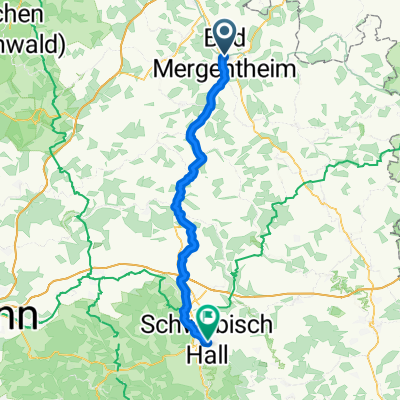
- 51.4 km
- Distance
- 684 m
- Ascent
- 685 m
- Descent
- ---
- Avg. speed
- 400 m
- Max. altitude
Route quality
Waytypes & surfaces along the route
Waytypes
Quiet road
15.4 km
(30 %)
Track
8.2 km
(16 %)
Surfaces
Paved
41.7 km
(81 %)
Asphalt
41.2 km
(80 %)
Paved (undefined)
0.5 km
(1 %)
Undefined
9.8 km
(19 %)
Continue with Bikemap
Use, edit, or download this cycling route
You would like to ride Grünkern-Tour or customize it for your own trip? Here is what you can do with this Bikemap route:
Free features
- Save this route as favorite or in collections
- Copy & plan your own version of this route
- Sync your route with Garmin or Wahoo
Premium features
Free trial for 3 days, or one-time payment. More about Bikemap Premium.
- Navigate this route on iOS & Android
- Export a GPX / KML file of this route
- Create your custom printout (try it for free)
- Download this route for offline navigation
Discover more Premium features.
Get Bikemap PremiumFrom our community
Other popular routes starting in Bad Mergentheim
 02 Bad Mergentheim nach Schwäbisch Hall
- Distance
- 57.7 km
- Ascent
- 1,026 m
- Descent
- 908 m
- Location
- Bad Mergentheim, Baden-Wurttemberg, Germany
 Marktplatz nach Kornmarkt 1A
- Distance
- 158.6 km
- Ascent
- 1,150 m
- Descent
- 1,256 m
- Location
- Bad Mergentheim, Baden-Wurttemberg, Germany
 Weikersheim - Colmberg
- Distance
- 71.5 km
- Ascent
- 942 m
- Descent
- 728 m
- Location
- Bad Mergentheim, Baden-Wurttemberg, Germany
 Route in Bad Mergentheim
- Distance
- 50.4 km
- Ascent
- 767 m
- Descent
- 770 m
- Location
- Bad Mergentheim, Baden-Wurttemberg, Germany
 HE02-Mergentheim-Colmberg
- Distance
- 67.8 km
- Ascent
- 450 m
- Descent
- 210 m
- Location
- Bad Mergentheim, Baden-Wurttemberg, Germany
 Von Giebelstadt bis Bad Mergentheim
- Distance
- 37.3 km
- Ascent
- 423 m
- Descent
- 338 m
- Location
- Bad Mergentheim, Baden-Wurttemberg, Germany
 Edelfingen nach Franke Straße
- Distance
- 14.3 km
- Ascent
- 189 m
- Descent
- 89 m
- Location
- Bad Mergentheim, Baden-Wurttemberg, Germany
 Brauerei-Tour
- Distance
- 71.5 km
- Ascent
- 782 m
- Descent
- 772 m
- Location
- Bad Mergentheim, Baden-Wurttemberg, Germany
Open it in the app