

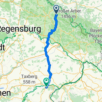
1991_Rimbach_R1_Hoher Bogen
A cycling route starting in Rimbach, Bavaria, Germany.
Overview
About this route
- -:--
- Duration
- 30.4 km
- Distance
- 764 m
- Ascent
- 764 m
- Descent
- ---
- Avg. speed
- ---
- Avg. speed

Route quality
Waytypes & surfaces along the route
Waytypes
Busy road
9.4 km
(31 %)
Access road
8.9 km
(29 %)
Surfaces
Paved
15.8 km
(52 %)
Unpaved
3 km
(10 %)
Asphalt
15.1 km
(50 %)
Ground
1.7 km
(6 %)
Continue with Bikemap
Use, edit, or download this cycling route
You would like to ride 1991_Rimbach_R1_Hoher Bogen or customize it for your own trip? Here is what you can do with this Bikemap route:
Free features
- Save this route as favorite or in collections
- Copy & plan your own version of this route
- Sync your route with Garmin or Wahoo
Premium features
Free trial for 3 days, or one-time payment. More about Bikemap Premium.
- Navigate this route on iOS & Android
- Export a GPX / KML file of this route
- Create your custom printout (try it for free)
- Download this route for offline navigation
Discover more Premium features.
Get Bikemap PremiumFrom our community
Other popular routes starting in Rimbach
 Drachensee-Runde
- Distance
- 26.5 km
- Ascent
- 379 m
- Descent
- 368 m
- Location
- Rimbach, Bavaria, Germany
 Haidstein-Wolframslinden-Runde
- Distance
- 17.3 km
- Ascent
- 421 m
- Descent
- 421 m
- Location
- Rimbach, Bavaria, Germany
 Hohenbogenstraße 2, Rimbach nach Hohenbogenstraße 2, Rimbach
- Distance
- 30.2 km
- Ascent
- 788 m
- Descent
- 788 m
- Location
- Rimbach, Bavaria, Germany
 1991_Rimbach_R3_Arberparkplatz
- Distance
- 34.5 km
- Ascent
- 708 m
- Descent
- 211 m
- Location
- Rimbach, Bavaria, Germany
 1991_Rimbach_R1_Hoher Bogen
- Distance
- 30.4 km
- Ascent
- 764 m
- Descent
- 764 m
- Location
- Rimbach, Bavaria, Germany
 Rimbach-Altötting
- Distance
- 140 km
- Ascent
- 1,138 m
- Descent
- 1,218 m
- Location
- Rimbach, Bavaria, Germany
 Runde Bayerische Wald, mit Runde um den Hohen Bogen
- Distance
- 212.1 km
- Ascent
- 1,849 m
- Descent
- 1,911 m
- Location
- Rimbach, Bavaria, Germany
 1991_Rimbach_R2_Vseruby
- Distance
- 48.9 km
- Ascent
- 594 m
- Descent
- 594 m
- Location
- Rimbach, Bavaria, Germany
Open it in the app