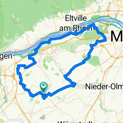
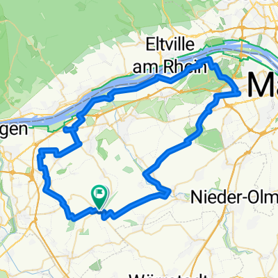
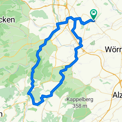
Ober-Hilbersheim - Ingelheim
A cycling route starting in Ober-Hilbersheim, Rhineland-Palatinate, Germany.
Overview
About this route
- -:--
- Duration
- 12.3 km
- Distance
- 22 m
- Ascent
- 146 m
- Descent
- ---
- Avg. speed
- 228 m
- Max. altitude
Route quality
Waytypes & surfaces along the route
Waytypes
Track
8.1 km
(66 %)
Quiet road
3.2 km
(26 %)
Surfaces
Paved
8 km
(65 %)
Unpaved
1.8 km
(15 %)
Asphalt
4.9 km
(40 %)
Paved (undefined)
3.1 km
(25 %)
Continue with Bikemap
Use, edit, or download this cycling route
You would like to ride Ober-Hilbersheim - Ingelheim or customize it for your own trip? Here is what you can do with this Bikemap route:
Free features
- Save this route as favorite or in collections
- Copy & plan your own version of this route
- Sync your route with Garmin or Wahoo
Premium features
Free trial for 3 days, or one-time payment. More about Bikemap Premium.
- Navigate this route on iOS & Android
- Export a GPX / KML file of this route
- Create your custom printout (try it for free)
- Download this route for offline navigation
Discover more Premium features.
Get Bikemap PremiumFrom our community
Other popular routes starting in Ober-Hilbersheim
- Ober-Hilbersheim - Ingelheim
- Distance
- 12.3 km
- Ascent
- 22 m
- Descent
- 146 m
- Location
- Ober-Hilbersheim, Rhineland-Palatinate, Germany
- Route nach Am Sonnenberg 17, Aspisheim
- Distance
- 5.5 km
- Ascent
- 37 m
- Descent
- 100 m
- Location
- Ober-Hilbersheim, Rhineland-Palatinate, Germany
- 14.08.
- Distance
- 49.1 km
- Ascent
- 505 m
- Descent
- 559 m
- Location
- Ober-Hilbersheim, Rhineland-Palatinate, Germany
- Bonavigo-Straße 7, Ober-Hilbersheim nach Schulstraße 21, Mommenheim
- Distance
- 24.5 km
- Ascent
- 228 m
- Descent
- 311 m
- Location
- Ober-Hilbersheim, Rhineland-Palatinate, Germany
- 07.08.25
- Distance
- 69.4 km
- Ascent
- 521 m
- Descent
- 515 m
- Location
- Ober-Hilbersheim, Rhineland-Palatinate, Germany
- 09.10. RRR
- Distance
- 74.7 km
- Ascent
- 1,066 m
- Descent
- 1,066 m
- Location
- Ober-Hilbersheim, Rhineland-Palatinate, Germany
- Schmittpforte 10, Ober-Hilbersheim nach Vor der Schmittpforte 14, Ober-Hilbersheim
- Distance
- 32.7 km
- Ascent
- 195 m
- Descent
- 181 m
- Location
- Ober-Hilbersheim, Rhineland-Palatinate, Germany
- Samstagsrunde
- Distance
- 100.6 km
- Ascent
- 735 m
- Descent
- 733 m
- Location
- Ober-Hilbersheim, Rhineland-Palatinate, Germany
Open it in the app