Swanland/Kidd Lane/Elloughton Dale/High Hunsley/Walkington/North Newbold(Bushey Hill/South Newbold/Trundlegate/ High Hunsley/ Riplingham/Raywell/Swanland.
A cycling route starting in North Ferriby, England, United Kingdom.
Overview
About this route
Climbs-Kidd Lane/Elloughton Dale/Trundlegate.
For fun come back via N.Ferrby and throw in Woodgates Lane  into Swanland village or perhaps Mill Hill.
- -:--
- Duration
- 44.8 km
- Distance
- 355 m
- Ascent
- 368 m
- Descent
- ---
- Avg. speed
- ---
- Avg. speed
Route quality
Waytypes & surfaces along the route
Waytypes
Quiet road
28 km
(62 %)
Road
16.8 km
(38 %)
Surfaces
Paved
28 km
(62 %)
Asphalt
28 km
(62 %)
Undefined
16.8 km
(38 %)
Continue with Bikemap
Use, edit, or download this cycling route
You would like to ride Swanland/Kidd Lane/Elloughton Dale/High Hunsley/Walkington/North Newbold(Bushey Hill/South Newbold/Trundlegate/ High Hunsley/ Riplingham/Raywell/Swanland. or customize it for your own trip? Here is what you can do with this Bikemap route:
Free features
- Save this route as favorite or in collections
- Copy & plan your own version of this route
- Sync your route with Garmin or Wahoo
Premium features
Free trial for 3 days, or one-time payment. More about Bikemap Premium.
- Navigate this route on iOS & Android
- Export a GPX / KML file of this route
- Create your custom printout (try it for free)
- Download this route for offline navigation
Discover more Premium features.
Get Bikemap PremiumFrom our community
Other popular routes starting in North Ferriby
- Ferriby 13mil
- Distance
- 19.3 km
- Ascent
- 239 m
- Descent
- 239 m
- Location
- North Ferriby, England, United Kingdom
- 22 High St, North Ferriby to Hesslewood Office Park, Ferriby Road, Hessle
- Distance
- 13.2 km
- Ascent
- 104 m
- Descent
- 109 m
- Location
- North Ferriby, England, United Kingdom
- Plum Tree Cottage, 2 Plantation Dr, North Ferriby to St. Andrew's Ward, Hull
- Distance
- 19.9 km
- Ascent
- 60 m
- Descent
- 72 m
- Location
- North Ferriby, England, United Kingdom
- Route from Melton Grange, Gibson Ln S, North Ferriby
- Distance
- 1.6 km
- Ascent
- 16 m
- Descent
- 7 m
- Location
- North Ferriby, England, United Kingdom
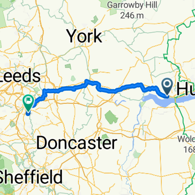
- 9 High Street, North Ferriby to 55 Manor Crescent, Wakefield
- Distance
- 89.2 km
- Ascent
- 276 m
- Descent
- 262 m
- Location
- North Ferriby, England, United Kingdom
- tvrrev2
- Distance
- 15.9 km
- Ascent
- 187 m
- Descent
- 187 m
- Location
- North Ferriby, England, United Kingdom
- The Manor House, 1 Woodgates Lane, North Ferriby to Uplands Cottage, 6 Woodgates Lane, North Ferriby
- Distance
- 13.9 km
- Ascent
- 156 m
- Descent
- 157 m
- Location
- North Ferriby, England, United Kingdom
- Swanland/Kidd Lane/Elloughton Dale/High Hunsley/Walkington/North Newbold(Bushey Hill/South Newbold/Trundlegate/ High Hunsley/ Riplingham/Raywell/Swanland.
- Distance
- 44.8 km
- Ascent
- 355 m
- Descent
- 368 m
- Location
- North Ferriby, England, United Kingdom
Open it in the app