
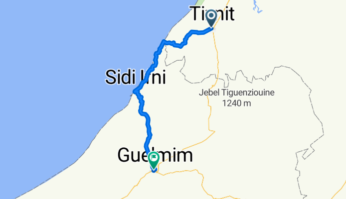
TIZNIT-SID IFNI-GUELMIM
A cycling route starting in Tiznit, Région de Souss-Massa-Drâa, Morocco.
Overview
About this route
- -:--
- Duration
- 130.3 km
- Distance
- 961 m
- Ascent
- 924 m
- Descent
- ---
- Avg. speed
- ---
- Max. altitude

Route quality
Waytypes & surfaces along the route
Waytypes
Quiet road
14.3 km
(11 %)
Track
6.5 km
(5 %)
Surfaces
Paved
110.8 km
(85 %)
Unpaved
1.3 km
(1 %)
Asphalt
110.8 km
(85 %)
Unpaved (undefined)
1.3 km
(1 %)
Undefined
18.2 km
(14 %)
Continue with Bikemap
Use, edit, or download this cycling route
You would like to ride TIZNIT-SID IFNI-GUELMIM or customize it for your own trip? Here is what you can do with this Bikemap route:
Free features
- Save this route as favorite or in collections
- Copy & plan your own version of this route
- Split it into stages to create a multi-day tour
- Sync your route with Garmin or Wahoo
Premium features
Free trial for 3 days, or one-time payment. More about Bikemap Premium.
- Navigate this route on iOS & Android
- Export a GPX / KML file of this route
- Create your custom printout (try it for free)
- Download this route for offline navigation
Discover more Premium features.
Get Bikemap PremiumFrom our community
Other popular routes starting in Tiznit
 BMA D09 Tiznit - Mirleft
- Distance
- 40.6 km
- Ascent
- 225 m
- Descent
- 416 m
- Location
- Tiznit, Région de Souss-Massa-Drâa, Morocco
 MAROKO 2017
- Distance
- 1,877.6 km
- Ascent
- 6,430 m
- Descent
- 6,668 m
- Location
- Tiznit, Région de Souss-Massa-Drâa, Morocco
 TIZNIT-SID IFNI-GUELMIM
- Distance
- 130.3 km
- Ascent
- 961 m
- Descent
- 924 m
- Location
- Tiznit, Région de Souss-Massa-Drâa, Morocco
 Route of Caravans: Morocco Traverse (South)
- Distance
- 1,125.4 km
- Ascent
- 15,049 m
- Descent
- 13,126 m
- Location
- Tiznit, Région de Souss-Massa-Drâa, Morocco
 Ocej
Ocej- Distance
- 675.3 km
- Ascent
- 2,762 m
- Descent
- 2,299 m
- Location
- Tiznit, Région de Souss-Massa-Drâa, Morocco
 Restful ride in Tafraoute
- Distance
- 118.2 km
- Ascent
- 2,394 m
- Descent
- 1,633 m
- Location
- Tiznit, Région de Souss-Massa-Drâa, Morocco
 BMA D10 Tiznit - Mirleft - Legzira - Sidi Ifni 71km
- Distance
- 70.4 km
- Ascent
- 381 m
- Descent
- 612 m
- Location
- Tiznit, Région de Souss-Massa-Drâa, Morocco
 Aglou Plage - Sidi Ifni
- Distance
- 65.4 km
- Ascent
- 476 m
- Descent
- 467 m
- Location
- Tiznit, Région de Souss-Massa-Drâa, Morocco
Open it in the app