

Foros- Fátima
A cycling route starting in Salvaterra de Magos, Santarém District, Portugal.
Overview
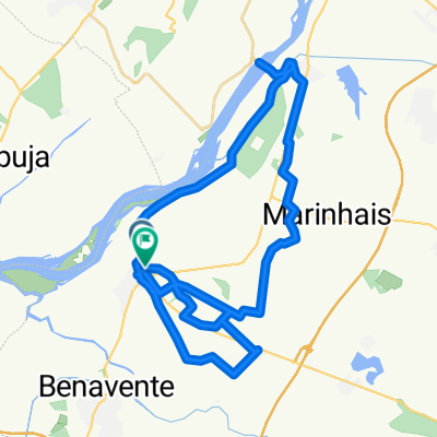
About this route
Ida Foros to Fátima, route to go on foot.
- -:--
- Duration
- 88 km
- Distance
- 644 m
- Ascent
- 318 m
- Descent
- ---
- Avg. speed
- ---
- Max. altitude
Route quality
Waytypes & surfaces along the route
Waytypes
Quiet road
14.1 km
(16 %)
Road
11.4 km
(13 %)
Surfaces
Paved
55.4 km
(63 %)
Unpaved
0.9 km
(1 %)
Asphalt
51 km
(58 %)
Paved (undefined)
4.4 km
(5 %)
Continue with Bikemap
Use, edit, or download this cycling route
You would like to ride Foros- Fátima or customize it for your own trip? Here is what you can do with this Bikemap route:
Free features
- Save this route as favorite or in collections
- Copy & plan your own version of this route
- Split it into stages to create a multi-day tour
- Sync your route with Garmin or Wahoo
Premium features
Free trial for 3 days, or one-time payment. More about Bikemap Premium.
- Navigate this route on iOS & Android
- Export a GPX / KML file of this route
- Create your custom printout (try it for free)
- Download this route for offline navigation
Discover more Premium features.
Get Bikemap PremiumFrom our community
Other popular routes starting in Salvaterra de Magos
 portugal day 8
- Distance
- 94.2 km
- Ascent
- 332 m
- Descent
- 283 m
- Location
- Salvaterra de Magos, Santarém District, Portugal
 Foros- Fátima
- Distance
- 88 km
- Ascent
- 644 m
- Descent
- 318 m
- Location
- Salvaterra de Magos, Santarém District, Portugal
 Foros, Coruche, raposa, Benfica , foros
- Distance
- 71.3 km
- Ascent
- 312 m
- Descent
- 315 m
- Location
- Salvaterra de Magos, Santarém District, Portugal
 Challange BTT Portugal 2010
- Distance
- 37.7 km
- Ascent
- 80 m
- Descent
- 76 m
- Location
- Salvaterra de Magos, Santarém District, Portugal
 foros, coruche, infantado, santo estevão, Benavente, foros
- Distance
- 78.7 km
- Ascent
- 248 m
- Descent
- 263 m
- Location
- Salvaterra de Magos, Santarém District, Portugal
 crazy
crazy- Distance
- 52.5 km
- Ascent
- 132 m
- Descent
- 187 m
- Location
- Salvaterra de Magos, Santarém District, Portugal
 N 3-3, Valada nach Golegã, Golegã
- Distance
- 68.3 km
- Ascent
- 2,987 m
- Descent
- 2,969 m
- Location
- Salvaterra de Magos, Santarém District, Portugal
 Volta ao Ribatejo
- Distance
- 345.4 km
- Ascent
- 820 m
- Descent
- 820 m
- Location
- Salvaterra de Magos, Santarém District, Portugal
Open it in the app