
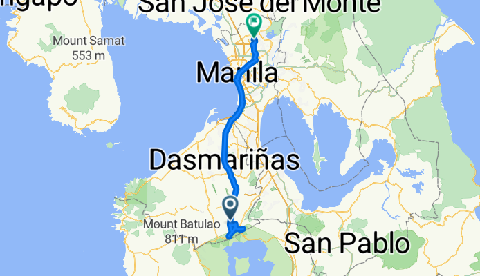
tagaytay Emilio Aguinaldo Highway, Silang to ACF Road 7a, Quezon City
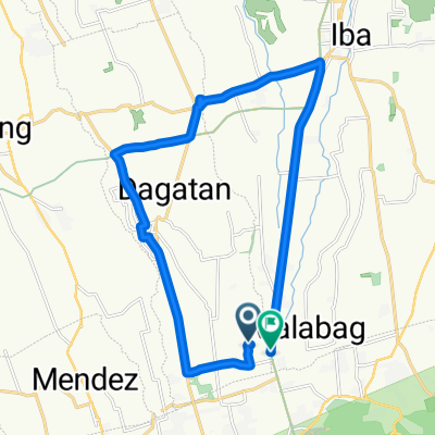
A cycling route starting in Malabag, Calabarzon, Philippines.
Overview
About this route
- 8 h 43 min
- Duration
- 92.2 km
- Distance
- 2,279 m
- Ascent
- 2,754 m
- Descent
- 10.6 km/h
- Avg. speed
- ---
- Avg. speed

Route quality
Waytypes & surfaces along the route
Waytypes
Busy road
47.2 km
(51 %)
Pedestrian area
14.8 km
(16 %)
Surfaces
Paved
66.3 km
(72 %)
Unpaved
2.8 km
(3 %)
Asphalt
43.1 km
(47 %)
Concrete
22.4 km
(24 %)
Continue with Bikemap
Use, edit, or download this cycling route
You would like to ride tagaytay Emilio Aguinaldo Highway, Silang to ACF Road 7a, Quezon City or customize it for your own trip? Here is what you can do with this Bikemap route:
Free features
- Save this route as favorite or in collections
- Copy & plan your own version of this route
- Split it into stages to create a multi-day tour
- Sync your route with Garmin or Wahoo
Premium features
Free trial for 3 days, or one-time payment. More about Bikemap Premium.
- Navigate this route on iOS & Android
- Export a GPX / KML file of this route
- Create your custom printout (try it for free)
- Download this route for offline navigation
Discover more Premium features.
Get Bikemap PremiumFrom our community
Other popular routes starting in Malabag
 Restful ride in Dasmariñas
- Distance
- 21.4 km
- Ascent
- 20 m
- Descent
- 361 m
- Location
- Malabag, Calabarzon, Philippines
 Route to General Emilio Aguinaldo Highway, Silang-tagaytay peoples park
- Distance
- 33 km
- Ascent
- 556 m
- Descent
- 550 m
- Location
- Malabag, Calabarzon, Philippines
 Emilio Aguinaldo Highway 150, Silang to Emilio Aguinaldo Highway 596, Silang
- Distance
- 28.2 km
- Ascent
- 722 m
- Descent
- 825 m
- Location
- Malabag, Calabarzon, Philippines
 amadeo-indang-alfonso-twin lakes-tagaytay short ride with pamangkin
- Distance
- 59.7 km
- Ascent
- 1,058 m
- Descent
- 1,059 m
- Location
- Malabag, Calabarzon, Philippines
 Santa Rosa - Tagaytay Road 213 to Calle Marcela Mariño Agoncillo, Taal
- Distance
- 49.8 km
- Ascent
- 628 m
- Descent
- 1,104 m
- Location
- Malabag, Calabarzon, Philippines
 Recovered Route
- Distance
- 26.1 km
- Ascent
- 368 m
- Descent
- 376 m
- Location
- Malabag, Calabarzon, Philippines
 amadeo-tagaytay-sampalok batangas sundy ride
- Distance
- 27.5 km
- Ascent
- 264 m
- Descent
- 797 m
- Location
- Malabag, Calabarzon, Philippines
 Recovered Route
- Distance
- 15.5 km
- Ascent
- 221 m
- Descent
- 220 m
- Location
- Malabag, Calabarzon, Philippines
Open it in the app