

Gherardesca San Ginese
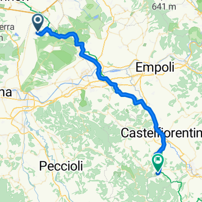
A cycling route starting in Orentano, Tuscany, Italy.
Overview
About this route
- -:--
- Duration
- 19.6 km
- Distance
- 271 m
- Ascent
- 270 m
- Descent
- ---
- Avg. speed
- ---
- Max. altitude

Route quality
Waytypes & surfaces along the route
Waytypes
Track
10.4 km
(53 %)
Quiet road
7.8 km
(40 %)
Surfaces
Paved
3.3 km
(17 %)
Unpaved
9.6 km
(49 %)
Ground
5.1 km
(26 %)
Gravel
4.1 km
(21 %)
Continue with Bikemap
Use, edit, or download this cycling route
You would like to ride Gherardesca San Ginese or customize it for your own trip? Here is what you can do with this Bikemap route:
Free features
- Save this route as favorite or in collections
- Copy & plan your own version of this route
- Sync your route with Garmin or Wahoo
Premium features
Free trial for 3 days, or one-time payment. More about Bikemap Premium.
- Navigate this route on iOS & Android
- Export a GPX / KML file of this route
- Create your custom printout (try it for free)
- Download this route for offline navigation
Discover more Premium features.
Get Bikemap PremiumFrom our community
Other popular routes starting in Orentano
 Gherardesca San Ginese
- Distance
- 19.6 km
- Ascent
- 271 m
- Descent
- 270 m
- Location
- Orentano, Tuscany, Italy
 PADULE - GIRO DEL LAGHETTO
- Distance
- 3.1 km
- Ascent
- 12 m
- Descent
- 13 m
- Location
- Orentano, Tuscany, Italy
 c\vecchio-s.jacopo-piavole-cvecchio
- Distance
- 28.5 km
- Ascent
- 828 m
- Descent
- 861 m
- Location
- Orentano, Tuscany, Italy
 Base to Gambassi
- Distance
- 50.5 km
- Ascent
- 763 m
- Descent
- 472 m
- Location
- Orentano, Tuscany, Italy
 round my hills, argus profile ...two laps,s.andrea climb and castel di nocco climb
- Distance
- 54.2 km
- Ascent
- 487 m
- Descent
- 488 m
- Location
- Orentano, Tuscany, Italy
 20111023-LaGamballaria
- Distance
- 82.3 km
- Ascent
- 903 m
- Descent
- 903 m
- Location
- Orentano, Tuscany, Italy
 quadrato_padule
- Distance
- 6 km
- Ascent
- 0 m
- Descent
- 0 m
- Location
- Orentano, Tuscany, Italy
 Ruota-M Serra
- Distance
- 8.1 km
- Ascent
- 588 m
- Descent
- 103 m
- Location
- Orentano, Tuscany, Italy
Open it in the app