

ciclovia
A cycling route starting in Cochabamba, Departamento de Cochabamba, Bolivia.
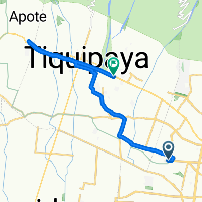
Overview
About this route
- 1 h 41 min
- Duration
- 12.3 km
- Distance
- 93 m
- Ascent
- 121 m
- Descent
- 7.3 km/h
- Avg. speed
- ---
- Max. altitude

Route photos


Route quality
Waytypes & surfaces along the route
Waytypes
Cycleway
10.1 km
(82 %)
Quiet road
1.6 km
(13 %)
Surfaces
Paved
12.1 km
(98 %)
Unpaved
0.1 km
(1 %)
Asphalt
11 km
(89 %)
Concrete
0.9 km
(7 %)
Continue with Bikemap
Use, edit, or download this cycling route
You would like to ride ciclovia or customize it for your own trip? Here is what you can do with this Bikemap route:
Free features
- Save this route as favorite or in collections
- Copy & plan your own version of this route
- Sync your route with Garmin or Wahoo
Premium features
Free trial for 3 days, or one-time payment. More about Bikemap Premium.
- Navigate this route on iOS & Android
- Export a GPX / KML file of this route
- Create your custom printout (try it for free)
- Download this route for offline navigation
Discover more Premium features.
Get Bikemap PremiumFrom our community
Other popular routes starting in Cochabamba
 Salida al Regina (por arriba)
- Distance
- 12 km
- Ascent
- 135 m
- Descent
- 75 m
- Location
- Cochabamba, Departamento de Cochabamba, Bolivia
 ciclovia
- Distance
- 12.3 km
- Ascent
- 93 m
- Descent
- 121 m
- Location
- Cochabamba, Departamento de Cochabamba, Bolivia
 Route 2 vuelta tiquipaya
- Distance
- 22.8 km
- Ascent
- 245 m
- Descent
- 245 m
- Location
- Cochabamba, Departamento de Cochabamba, Bolivia
 De Camino al Paso a Unnamed Road, Cochabamba
- Distance
- 16.3 km
- Ascent
- 126 m
- Descent
- 203 m
- Location
- Cochabamba, Departamento de Cochabamba, Bolivia
 Universidad
- Distance
- 10.4 km
- Ascent
- 120 m
- Descent
- 22 m
- Location
- Cochabamba, Departamento de Cochabamba, Bolivia
 Quillacollo - Tunari
- Distance
- 24.4 km
- Ascent
- 1,463 m
- Descent
- 14 m
- Location
- Cochabamba, Departamento de Cochabamba, Bolivia
 paseo túnel del Abra
- Distance
- 22.5 km
- Ascent
- 315 m
- Descent
- 320 m
- Location
- Cochabamba, Departamento de Cochabamba, Bolivia
 Quillacollo - Calio - Liriuni - Quillacollo - Arocagua
- Distance
- 45.1 km
- Ascent
- 677 m
- Descent
- 574 m
- Location
- Cochabamba, Departamento de Cochabamba, Bolivia
Open it in the app