Gainesville-Hawthorne & south leg to Ocala NF
A cycling route starting in Gainesville, Florida, United States.
Overview
About this route
- -:--
- Duration
- 146.6 km
- Distance
- 154 m
- Ascent
- 174 m
- Descent
- ---
- Avg. speed
- ---
- Max. altitude
Route quality
Waytypes & surfaces along the route
Waytypes
Road
39.6 km
(27 %)
Cycleway
22 km
(15 %)
Surfaces
Paved
55.7 km
(38 %)
Unpaved
7.3 km
(5 %)
Asphalt
42.5 km
(29 %)
Paved (undefined)
13.2 km
(9 %)
Route highlights
Points of interest along the route
Point of interest after 1 km
Sweetwater Overlook
Point of interest after 1.5 km
La Chua Trail - Observation Tower
Point of interest after 2.9 km
Alachua Lake Overlook
Point of interest after 7.8 km
Prairie Creek Boardwalk
Point of interest after 10.4 km
~Est: Prairie Creek Preserve Trails
Point of interest after 15.6 km
Phifer Flatwoods Preserve (~3 trails)
Continue with Bikemap
Use, edit, or download this cycling route
You would like to ride Gainesville-Hawthorne & south leg to Ocala NF or customize it for your own trip? Here is what you can do with this Bikemap route:
Free features
- Save this route as favorite or in collections
- Copy & plan your own version of this route
- Split it into stages to create a multi-day tour
- Sync your route with Garmin or Wahoo
Premium features
Free trial for 3 days, or one-time payment. More about Bikemap Premium.
- Navigate this route on iOS & Android
- Export a GPX / KML file of this route
- Create your custom printout (try it for free)
- Download this route for offline navigation
Discover more Premium features.
Get Bikemap PremiumFrom our community
Other popular routes starting in Gainesville
- Micanopy Gravel
- Distance
- 52.2 km
- Ascent
- 704 m
- Descent
- 708 m
- Location
- Gainesville, Florida, United States
- half hawthorne #3
- Distance
- 29.6 km
- Ascent
- 517 m
- Descent
- 504 m
- Location
- Gainesville, Florida, United States
- Hawthorne Circuit
- Distance
- 71.7 km
- Ascent
- 88 m
- Descent
- 86 m
- Location
- Gainesville, Florida, United States
- HBG HH22
- Distance
- 11.9 km
- Ascent
- 321 m
- Descent
- 307 m
- Location
- Gainesville, Florida, United States
- prairie gravel
- Distance
- 58.1 km
- Ascent
- 299 m
- Descent
- 287 m
- Location
- Gainesville, Florida, United States
- Depot to Prairie Creek
- Distance
- 11.1 km
- Ascent
- 184 m
- Descent
- 202 m
- Location
- Gainesville, Florida, United States
- Century of the Century
- Distance
- 156.7 km
- Ascent
- 389 m
- Descent
- 372 m
- Location
- Gainesville, Florida, United States
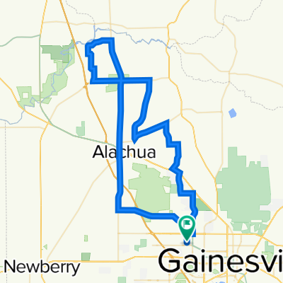
- Historic Gainesville Bike Trail
- Distance
- 5.5 km
- Ascent
- 142 m
- Descent
- 141 m
- Location
- Gainesville, Florida, United States
Open it in the app