

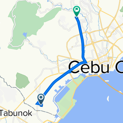
L. Gabuya Street, Cebu City to Unnamed Road, San Fernando
A cycling route starting in Tangke, Western Visayas, Philippines.
Overview
About this route
- -:--
- Duration
- 35.5 km
- Distance
- 701 m
- Ascent
- 438 m
- Descent
- ---
- Avg. speed
- ---
- Max. altitude

Route photos

Route quality
Waytypes & surfaces along the route
Waytypes
Road
16.1 km
(45 %)
Quiet road
13.1 km
(37 %)
Surfaces
Paved
14.4 km
(41 %)
Unpaved
1.8 km
(5 %)
Paved (undefined)
8 km
(23 %)
Concrete
3.5 km
(10 %)
Continue with Bikemap
Use, edit, or download this cycling route
You would like to ride L. Gabuya Street, Cebu City to Unnamed Road, San Fernando or customize it for your own trip? Here is what you can do with this Bikemap route:
Free features
- Save this route as favorite or in collections
- Copy & plan your own version of this route
- Sync your route with Garmin or Wahoo
Premium features
Free trial for 3 days, or one-time payment. More about Bikemap Premium.
- Navigate this route on iOS & Android
- Export a GPX / KML file of this route
- Create your custom printout (try it for free)
- Download this route for offline navigation
Discover more Premium features.
Get Bikemap PremiumFrom our community
Other popular routes starting in Tangke
 CCLEX
CCLEX- Distance
- 17.2 km
- Ascent
- 94 m
- Descent
- 94 m
- Location
- Tangke, Western Visayas, Philippines
 7V95+HJM, Cebu City to V Rama Avenue 1377, Cebu City
- Distance
- 8.6 km
- Ascent
- 53 m
- Descent
- 12 m
- Location
- Tangke, Western Visayas, Philippines
 Cebu South Road 106, Cebu City to Katipunan Street 584, Cebu City
- Distance
- 3.7 km
- Ascent
- 36 m
- Descent
- 34 m
- Location
- Tangke, Western Visayas, Philippines
 2nd day
- Distance
- 19.6 km
- Ascent
- 124 m
- Descent
- 124 m
- Location
- Tangke, Western Visayas, Philippines
 L. Gabuya Street, Cebu City to Unnamed Road, San Fernando
- Distance
- 35.5 km
- Ascent
- 701 m
- Descent
- 438 m
- Location
- Tangke, Western Visayas, Philippines
 HOMES
HOMES- Distance
- 0 km
- Ascent
- 0 m
- Descent
- 0 m
- Location
- Tangke, Western Visayas, Philippines
 Central Cebu Loop
- Distance
- 155.5 km
- Ascent
- 1,264 m
- Descent
- 1,265 m
- Location
- Tangke, Western Visayas, Philippines
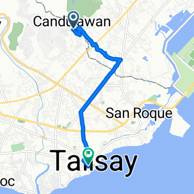 TALISAY
- Distance
- 5.8 km
- Ascent
- 7 m
- Descent
- 56 m
- Location
- Tangke, Western Visayas, Philippines
Open it in the app