

Hühnerscheerberg - Wanderweg 3
A cycling route starting in Fürstenhausen, Saarland, Germany.
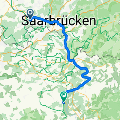
Overview
About this route
The starting point is the parking lot at the Hühnerscheerberg water reservoir (access via the street Am Hasseleich)
Monument from 1870 - Marian Chapel - Forest pond - Honor spring
Panoramic view of the Blas steelworks, the city center with the church towers of St. Eligius and the Reconciliation Church, the New Town Hall, Kreuzberg. In good weather, view as far as Schaumberg.
- -:--
- Duration
- 3.1 km
- Distance
- 99 m
- Ascent
- 99 m
- Descent
- ---
- Avg. speed
- ---
- Max. altitude
Route quality
Waytypes & surfaces along the route
Waytypes
Track
2.4 km
(77 %)
Path
0.7 km
(22 %)
Steps
0 km
(1 %)
Surfaces
Unpaved
2.8 km
(91 %)
Unpaved (undefined)
1.5 km
(49 %)
Gravel
0.9 km
(30 %)
Continue with Bikemap
Use, edit, or download this cycling route
You would like to ride Hühnerscheerberg - Wanderweg 3 or customize it for your own trip? Here is what you can do with this Bikemap route:
Free features
- Save this route as favorite or in collections
- Copy & plan your own version of this route
- Sync your route with Garmin or Wahoo
Premium features
Free trial for 3 days, or one-time payment. More about Bikemap Premium.
- Navigate this route on iOS & Android
- Export a GPX / KML file of this route
- Create your custom printout (try it for free)
- Download this route for offline navigation
Discover more Premium features.
Get Bikemap PremiumFrom our community
Other popular routes starting in Fürstenhausen
 VK Test
- Distance
- 53.1 km
- Ascent
- 643 m
- Descent
- 609 m
- Location
- Fürstenhausen, Saarland, Germany
 Sofienstraße 5, Völklingen nach Sofienstraße 3, Völklingen
- Distance
- 27.9 km
- Ascent
- 271 m
- Descent
- 267 m
- Location
- Fürstenhausen, Saarland, Germany
 Fürstenhausen - Keskastel
- Distance
- 56.2 km
- Ascent
- 278 m
- Descent
- 272 m
- Location
- Fürstenhausen, Saarland, Germany
 3. nap Mosel
- Distance
- 100.7 km
- Ascent
- 430 m
- Descent
- 290 m
- Location
- Fürstenhausen, Saarland, Germany
 dienstags nach spichern
- Distance
- 29.4 km
- Ascent
- 226 m
- Descent
- 222 m
- Location
- Fürstenhausen, Saarland, Germany
 Hühnerscheerberg - Wanderweg 3
- Distance
- 3.1 km
- Ascent
- 99 m
- Descent
- 99 m
- Location
- Fürstenhausen, Saarland, Germany
 Sofienstraße 34, Völklingen nach 106 Rue Principale, Petite-Rosselle
- Distance
- 8 km
- Ascent
- 153 m
- Descent
- 90 m
- Location
- Fürstenhausen, Saarland, Germany
 Warndt (VeloRoute SaarLorLux)
- Distance
- 38.1 km
- Ascent
- 490 m
- Descent
- 489 m
- Location
- Fürstenhausen, Saarland, Germany
Open it in the app