

Madesimo-Montespluga
A cycling route starting in Campodolcino, Lombardy, Italy.
Overview
About this route
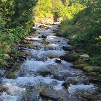
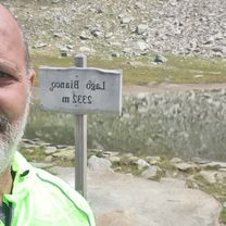
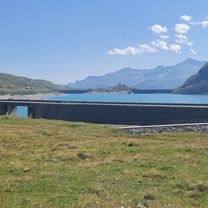
Madesimo-Andossi-Lake of Andossi-Montespluga-Pianazzo-Madesimo
- -:--
- Duration
- 25.3 km
- Distance
- 710 m
- Ascent
- 707 m
- Descent
- ---
- Avg. speed
- ---
- Max. altitude

Route quality
Waytypes & surfaces along the route
Waytypes
Track
9.1 km
(36 %)
Quiet road
1.3 km
(5 %)
Surfaces
Paved
14.4 km
(57 %)
Unpaved
8.9 km
(35 %)
Asphalt
14.4 km
(57 %)
Gravel
6.3 km
(25 %)
Continue with Bikemap
Use, edit, or download this cycling route
You would like to ride Madesimo-Montespluga or customize it for your own trip? Here is what you can do with this Bikemap route:
Free features
- Save this route as favorite or in collections
- Copy & plan your own version of this route
- Sync your route with Garmin or Wahoo
Premium features
Free trial for 3 days, or one-time payment. More about Bikemap Premium.
- Navigate this route on iOS & Android
- Export a GPX / KML file of this route
- Create your custom printout (try it for free)
- Download this route for offline navigation
Discover more Premium features.
Get Bikemap PremiumFrom our community
Other popular routes starting in Campodolcino
 Madesimo - Larici - Motta - Madesimo
- Distance
- 12.8 km
- Ascent
- 503 m
- Descent
- 503 m
- Location
- Campodolcino, Lombardy, Italy
 Da Via G. Carducci a Via G. Carducci
- Distance
- 3.4 km
- Ascent
- 60 m
- Descent
- 105 m
- Location
- Campodolcino, Lombardy, Italy
 Da Via G. Carducci a Via G. Carducci
- Distance
- 31.6 km
- Ascent
- 1,356 m
- Descent
- 1,410 m
- Location
- Campodolcino, Lombardy, Italy
 Da Via G. Carducci a Via G. Carducci
- Distance
- 30.3 km
- Ascent
- 836 m
- Descent
- 877 m
- Location
- Campodolcino, Lombardy, Italy
 Campodolcino to Schaan
- Distance
- 118.3 km
- Ascent
- 1,448 m
- Descent
- 2,079 m
- Location
- Campodolcino, Lombardy, Italy
 Larici-Motta-Madesimo
- Distance
- 16.4 km
- Ascent
- 494 m
- Descent
- 541 m
- Location
- Campodolcino, Lombardy, Italy
 Madesimo gualdera
- Distance
- 22.4 km
- Ascent
- 949 m
- Descent
- 951 m
- Location
- Campodolcino, Lombardy, Italy
 Madesimo-Montespluga
- Distance
- 25.3 km
- Ascent
- 710 m
- Descent
- 707 m
- Location
- Campodolcino, Lombardy, Italy
Open it in the app