

Rushteam dimanche 4 avril
A cycling route starting in Écublens, Canton of Vaud, Switzerland.
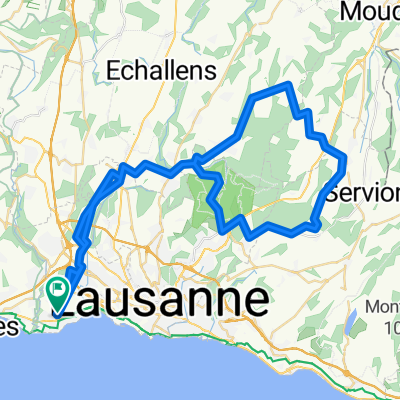
Overview
About this route
Ecublens - Morges - Apples - Pampigny - Lisles - Moiry - La Sarraz - Orbe* - Mathod - Ependes - Suchy - Penthéréaz - St Barthélemy - Sulens - Bussigny - Ecublens
- Possibilité de raccourcir à Orbe sur Chavornay - Bavois - Oulens
- -:--
- Duration
- 84.2 km
- Distance
- 599 m
- Ascent
- 604 m
- Descent
- ---
- Avg. speed
- ---
- Max. altitude
Route quality
Waytypes & surfaces along the route
Waytypes
Busy road
31.2 km
(37 %)
Road
30.7 km
(36 %)
Surfaces
Paved
48.7 km
(58 %)
Unpaved
0.4 km
(<1 %)
Asphalt
43.4 km
(52 %)
Concrete
3.5 km
(4 %)
Continue with Bikemap
Use, edit, or download this cycling route
You would like to ride Rushteam dimanche 4 avril or customize it for your own trip? Here is what you can do with this Bikemap route:
Free features
- Save this route as favorite or in collections
- Copy & plan your own version of this route
- Split it into stages to create a multi-day tour
- Sync your route with Garmin or Wahoo
Premium features
Free trial for 3 days, or one-time payment. More about Bikemap Premium.
- Navigate this route on iOS & Android
- Export a GPX / KML file of this route
- Create your custom printout (try it for free)
- Download this route for offline navigation
Discover more Premium features.
Get Bikemap PremiumFrom our community
Other popular routes starting in Écublens
 Lausanne-Col de Jaman
- Distance
- 94.1 km
- Ascent
- 1,539 m
- Descent
- 1,539 m
- Location
- Écublens, Canton of Vaud, Switzerland
 Le Tour 2017 heen
- Distance
- 75 km
- Ascent
- 1,123 m
- Descent
- 373 m
- Location
- Écublens, Canton of Vaud, Switzerland
 Ecublens - vallée de Joux AR
- Distance
- 85.8 km
- Ascent
- 1,307 m
- Descent
- 1,315 m
- Location
- Écublens, Canton of Vaud, Switzerland
 2011-11-20 Pas de morgins
- Distance
- 141.4 km
- Ascent
- 1,077 m
- Descent
- 1,077 m
- Location
- Écublens, Canton of Vaud, Switzerland
 tour du lac plus halte a montreux
- Distance
- 192.3 km
- Ascent
- 550 m
- Descent
- 550 m
- Location
- Écublens, Canton of Vaud, Switzerland
 Long Friday Track In St-Sulpice Vd
- Distance
- 15.1 km
- Ascent
- 39 m
- Descent
- 28 m
- Location
- Écublens, Canton of Vaud, Switzerland
 Porrentruy 2021 - Vendredi
- Distance
- 64.9 km
- Ascent
- 736 m
- Descent
- 737 m
- Location
- Écublens, Canton of Vaud, Switzerland
 tour du lac comme un con
- Distance
- 168.8 km
- Ascent
- 353 m
- Descent
- 353 m
- Location
- Écublens, Canton of Vaud, Switzerland
Open it in the app