

Mountain bike sport route
A cycling route starting in Llanfyllin, Wales, United Kingdom.
Overview
About this route
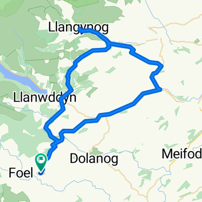
12.6km / 7.8 miles this will be my control loop which i will do every sunday.
- -:--
- Duration
- 12.6 km
- Distance
- 274 m
- Ascent
- 274 m
- Descent
- ---
- Avg. speed
- ---
- Avg. speed
Route quality
Waytypes & surfaces along the route
Waytypes
Quiet road
8.1 km
(64 %)
Busy road
4.2 km
(34 %)
Surfaces
Paved
8.3 km
(66 %)
Asphalt
8.3 km
(66 %)
Undefined
4.2 km
(34 %)
Continue with Bikemap
Use, edit, or download this cycling route
You would like to ride Mountain bike sport route or customize it for your own trip? Here is what you can do with this Bikemap route:
Free features
- Save this route as favorite or in collections
- Copy & plan your own version of this route
- Sync your route with Garmin or Wahoo
Premium features
Free trial for 3 days, or one-time payment. More about Bikemap Premium.
- Navigate this route on iOS & Android
- Export a GPX / KML file of this route
- Create your custom printout (try it for free)
- Download this route for offline navigation
Discover more Premium features.
Get Bikemap PremiumFrom our community
Other popular routes starting in Llanfyllin
 Hidden valleys circuit
- Distance
- 54.5 km
- Ascent
- 697 m
- Descent
- 694 m
- Location
- Llanfyllin, Wales, United Kingdom
 wales 105/1840
- Distance
- 105.4 km
- Ascent
- 1,512 m
- Descent
- 1,505 m
- Location
- Llanfyllin, Wales, United Kingdom
 wales 91/1520
- Distance
- 91.1 km
- Ascent
- 1,219 m
- Descent
- 1,219 m
- Location
- Llanfyllin, Wales, United Kingdom
 Hells Fire Pass
- Distance
- 56.4 km
- Ascent
- 807 m
- Descent
- 807 m
- Location
- Llanfyllin, Wales, United Kingdom
 Road bike sport route Week 1
- Distance
- 26.5 km
- Ascent
- 386 m
- Descent
- 388 m
- Location
- Llanfyllin, Wales, United Kingdom
 Road bike sport route week 4
- Distance
- 52.2 km
- Ascent
- 350 m
- Descent
- 353 m
- Location
- Llanfyllin, Wales, United Kingdom
 Mountain bike sport route
- Distance
- 12.6 km
- Ascent
- 274 m
- Descent
- 274 m
- Location
- Llanfyllin, Wales, United Kingdom
 Eglwys Llanfihangel to Cae Coch
- Distance
- 93.1 km
- Ascent
- 1,291 m
- Descent
- 1,216 m
- Location
- Llanfyllin, Wales, United Kingdom
Open it in the app