
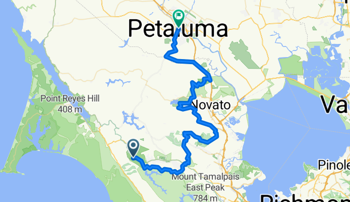
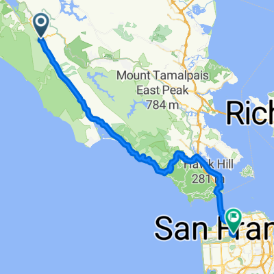
BART: Sam Taylor to Petaluma
A cycling route starting in Lagunitas-Forest Knolls, California, United States.
Overview
About this route
Some variation from CN route near Mt Burdell. Does not include Indian Tree climb (O/B).
- -:--
- Duration
- 79.3 km
- Distance
- 2,441 m
- Ascent
- 2,505 m
- Descent
- ---
- Avg. speed
- ---
- Max. altitude
Route quality
Waytypes & surfaces along the route
Waytypes
Track
32.7 km
(41 %)
Path
18.3 km
(23 %)
Surfaces
Paved
7.1 km
(9 %)
Unpaved
16.8 km
(21 %)
Ground
7.5 km
(9 %)
Unpaved (undefined)
7.2 km
(9 %)
Continue with Bikemap
Use, edit, or download this cycling route
You would like to ride BART: Sam Taylor to Petaluma or customize it for your own trip? Here is what you can do with this Bikemap route:
Free features
- Save this route as favorite or in collections
- Copy & plan your own version of this route
- Sync your route with Garmin or Wahoo
Premium features
Free trial for 3 days, or one-time payment. More about Bikemap Premium.
- Navigate this route on iOS & Android
- Export a GPX / KML file of this route
- Create your custom printout (try it for free)
- Download this route for offline navigation
Discover more Premium features.
Get Bikemap PremiumFrom our community
Other popular routes starting in Lagunitas-Forest Knolls
 nicasio - bolinas - panoramic loop
- Distance
- 93.5 km
- Ascent
- 1,489 m
- Descent
- 1,489 m
- Location
- Lagunitas-Forest Knolls, California, United States
 Nicasio Olema Loop enduro
- Distance
- 34.8 km
- Ascent
- 371 m
- Descent
- 367 m
- Location
- Lagunitas-Forest Knolls, California, United States
 Olema Loop
- Distance
- 81.5 km
- Ascent
- 520 m
- Descent
- 522 m
- Location
- Lagunitas-Forest Knolls, California, United States
 Bolinas Ridge to Hawk Camp
- Distance
- 46.7 km
- Ascent
- 1,534 m
- Descent
- 1,342 m
- Location
- Lagunitas-Forest Knolls, California, United States
 Olema to home
- Distance
- 59.3 km
- Ascent
- 856 m
- Descent
- 808 m
- Location
- Lagunitas-Forest Knolls, California, United States
 BART: Sam Taylor to Petaluma
- Distance
- 79.3 km
- Ascent
- 2,441 m
- Descent
- 2,505 m
- Location
- Lagunitas-Forest Knolls, California, United States
 7/29/23 - 2.5hr loop
- Distance
- 70.9 km
- Ascent
- 917 m
- Descent
- 919 m
- Location
- Lagunitas-Forest Knolls, California, United States
 Nicasio to Kehoe and back
- Distance
- 72.1 km
- Ascent
- 478 m
- Descent
- 475 m
- Location
- Lagunitas-Forest Knolls, California, United States
Open it in the app