


Tom Bollegem
- 48.4 km
- 173 m
- 172 m
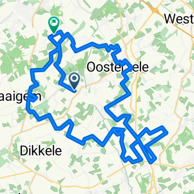
- Oosterzele, Flemish Region, Belgium
A cycling route starting in Oosterzele, Flemish Region, Belgium.
Overview
This is the original bunker route as it already existed in 2006, starting from the Municipality of Oosterzele. However, since its inception, it has not always been well maintained despite the many narrow field paths it contains. Also, many opportunities to see bunkers are missed. There are definitely better variants to be found in the same region to certainly see more bunkers.
created this 4 years ago
Route quality
Path
4.3 km
(34 %)
Quiet road
4.1 km
(32 %)
Paved
4.1 km
(32 %)
Unpaved
6.2 km
(49 %)
Ground
5.5 km
(43 %)
Concrete
2.8 km
(22 %)
Continue with Bikemap
You would like to ride Originele Bunkerroute Oosterzele or customize it for your own trip? Here is what you can do with this Bikemap route:
Free trial for 3 days, or one-time payment. More about Bikemap Premium.
Discover more Premium features.
Get Bikemap PremiumFrom our community
Open it in the app


