Schweiz, Veloroute 9, Unterägeri - Einsiedeln - Rapperswil
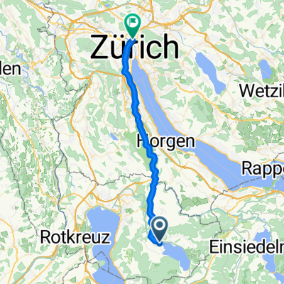
A cycling route starting in Unterägeri, Canton of Zug, Switzerland.
Overview
About this route
Beautiful route with a small climb between Ägerisee and Sihlsee. From there, it goes downhill to Rapperswil with a great view of Lake Zurich.
- -:--
- Duration
- 56.1 km
- Distance
- 523 m
- Ascent
- 828 m
- Descent
- ---
- Avg. speed
- ---
- Max. altitude
Continue with Bikemap
Use, edit, or download this cycling route
You would like to ride Schweiz, Veloroute 9, Unterägeri - Einsiedeln - Rapperswil or customize it for your own trip? Here is what you can do with this Bikemap route:
Free features
- Save this route as favorite or in collections
- Copy & plan your own version of this route
- Sync your route with Garmin or Wahoo
Premium features
Free trial for 3 days, or one-time payment. More about Bikemap Premium.
- Navigate this route on iOS & Android
- Export a GPX / KML file of this route
- Create your custom printout (try it for free)
- Download this route for offline navigation
Discover more Premium features.
Get Bikemap PremiumFrom our community
Other popular routes starting in Unterägeri
- Unterägeri Ramenegg
- Distance
- 14.5 km
- Ascent
- 661 m
- Descent
- 253 m
- Location
- Unterägeri, Canton of Zug, Switzerland
- Mittelschwere Route im Aegerital
- Distance
- 40.3 km
- Ascent
- 1,099 m
- Descent
- 1,096 m
- Location
- Unterägeri, Canton of Zug, Switzerland
- Restful route in Unterägeri
- Distance
- 25.6 km
- Ascent
- 683 m
- Descent
- 687 m
- Location
- Unterägeri, Canton of Zug, Switzerland
- Lunch ride
- Distance
- 20.6 km
- Ascent
- 444 m
- Descent
- 445 m
- Location
- Unterägeri, Canton of Zug, Switzerland
- wildspitz
- Distance
- 29.1 km
- Ascent
- 893 m
- Descent
- 879 m
- Location
- Unterägeri, Canton of Zug, Switzerland
- Unterägeri-Morgartenberg-Raten-Unterägeri
- Distance
- 28.9 km
- Ascent
- 605 m
- Descent
- 605 m
- Location
- Unterägeri, Canton of Zug, Switzerland
- Ländli - Äegerisee
- Distance
- 14.8 km
- Ascent
- 87 m
- Descent
- 86 m
- Location
- Unterägeri, Canton of Zug, Switzerland
- Unterägeri-Sattel-Wildspitz-Unterägeri
- Distance
- 28.4 km
- Ascent
- 839 m
- Descent
- 839 m
- Location
- Unterägeri, Canton of Zug, Switzerland
Open it in the app